Memphis in Shelby County, Tennessee — The American South (East South Central)
Tennessee
Photographed by Sandra Hughes, May 18, 2010
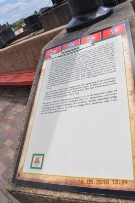
1. Tennessee Marker
Tennessee was a Pro-Union state until the beginning of the Civil War, and was the last state to secede from the Union in 1861. It was a major battleground during the war, and became the first Confederate state to rejoin the Union at the war's end.
Memphis, which is Tennessee's largest city, is the regional center of a three state area, which includes western Tennessee, northern Mississippi, and eastern Arkansas. It is a cotton, lumber, manufacturing, and distribution center; as well as a major U.S. highway, rail, river, and air transportation hub.
Topics and series. This historical marker is listed in this topic list: War, US Civil. In addition, it is included in the Former U.S. Presidents: #07 Andrew Jackson series list. A significant historical year for this entry is 1796.
Location. 35° 8.656′ N, 90° 3.562′ W. Marker is in Memphis, Tennessee, in Shelby County. It
this page online

Regionally, this marker is in West Tennessee. It is also in the American South, specifically in the Deep South, in the Upper South, in the Mississippi Delta, and in the Great River Road Region. Globally, it is in North America, the Western Hemisphere, the Western World, and the Anglosphere. Historically, it finds itself in what was once the territory of the Mississippian Culture, one of the Confederate States of America, and the Antebellum South.
Other nearby markers. At least 8 other markers are within walking distance of this marker: North Carolina (here, next to this marker); Great Britain (here, next to this marker); France (here, next to this marker); Confederate States of America (here, next to this marker); Spain (a few steps from this marker); Head of Passes/Pilottown, Louisiana (about 700 feet away, measured in a direct line); Venice Louisiana/Fort Jackson, Louisiana/Fort St. Phillip (about 700 feet away); Ostrica Lock/Buras, Louisiana/Empire Lock/Nairn, Louisiana

Photographed by Sandra Hughes, May 18, 2010
2. Tennessee Flag
France, Spain, North Carolina, Tennessee, US, Confederate States, Great Britain Flags
Photographed by Sandra Hughes, May 18, 2010
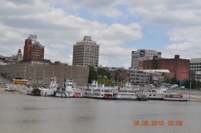
3. Memphis Tennessee along the Mississippi River Banks

Photographed by Sandra Hughes, May 18, 2010
4. Mud Island, Railway, Interstate Major Highways

Photographed by Sandra Hughes, May 18, 2010
5. Fed X Air Transportation Hub in Memphis
Photographed by Sandra Hughes, May 18, 2010
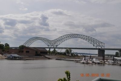
6. Bridge connecting Tennessee to Arkansas via Mississippi River
Credits. This page was last revised on June 16, 2016. It was originally submitted on March 20, 2012, by Sandra Hughes Tidwell of Killen, Alabama, USA. This page has been viewed 704 times since then and 12 times this year. Last updated on May 3, 2015, by J. Makali Bruton of Washington, District of Columbia. Photos: 1, 2, 3, 4, 5, 6. submitted on March 20, 2012, by Sandra Hughes Tidwell of Killen, Alabama, USA. • Bill Pfingsten was the editor who published this page.
