Downtown Memphis in Shelby County, Tennessee — The American South (East South Central)
Tom Lee Monument
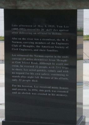
Also on the river was a steamboat, the M. E. Norman, carrying members of the Engineers Club of Memphis, the American Society of Civil Engineers, and their families.
Lee witnessed the Norman capsize in the swift current 15 miles downriver from Memphis at Cow Island Bend. Although he could not swim, he rescued 32 people with five trips to shore. Lee acted quickly, calmly and with no regard for his own safety, continuing to search after night fell. Because of his efforts, only 23 people died.
For his heroism, Lee received many honors and awards. In 1954, this park was renamed and an obelisk was erected in his memory.
Erected 2006.
Topics. This historical marker and monument is listed in these topic lists: African Americans • Civil Rights • Heroes • Waterways & Vessels. A significant historical date for this entry is May 8, 1869.
Location. 35° 8.119′ N, 90° 3.882′ W. Marker is in Memphis, Tennessee, in Shelby County. It is in Downtown Memphis. Marker can be reached from Riverside Drive. Monument is in Tom Lee Park, on the Mississippi riverfront near the foot of Beale Street in Memphis. The park was the first named for an African American. Touch for map. Marker is in this post office area: Memphis TN 38103, United States of America. Touch for directions.
Other nearby markers. At least 8 other markers are within walking distance of this marker. Tom Lee Memorial (approx. 0.2 miles away); Site of First Memphis Telephone (approx. ¼ mile away); The Blues Foundation (approx. 0.3 miles away); Arcade Restaurant (approx. 0.4 miles away); Modern Movie~Making In Memphis (approx. 0.4 miles away); They Passed This Way (approx. 0.4 miles away); James A. Hyter, “Ol’ Man River” (approx. 0.4 miles away); John James Audubon (approx. 0.4 miles away). Touch for a list and map of all markers in Memphis.
More about this monument. The sculptural monument is a complement to the original obelisk, reconstructed after damage from "Hurricane Elvis" - both monuments now stand in Tom Lee Park. See the Tom Lee Monument in the Other nearby markers section above.
Regarding Tom Lee Monument. The Tom Lee monument was selected as the site of a 2008 ceremony to honor Dr. Martin Luther King by Amnesty International, working with the National Civil Rights Museum, AFSCME Local 1733, the Memphis chapter of the NAACP, Southwest Tennessee Community College and the Southern Christian Leadership Conference. The Tom Lee Recognitions will honor local civil rights champions.
Also see . . .

Photographed By Mary Johnston-Clark, November 18, 2006
2. Tom Lee Monument
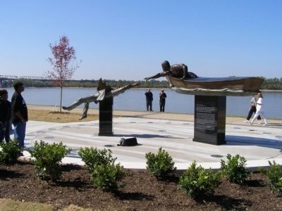
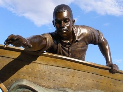
The Tom Lee Monument by sculptor David Alan Clark is sited on the banks of the Mississippi River. Visitors are encouraged to walk up to the figure of Lee, reaching out from his boat, and grasp his hand. The waterline of the boat is at visitor's eye level, and the plaza is etched with river currants, giving visitors the feeling of being in the water awaiting rescue.
Credits. This page was last revised on February 7, 2023. It was originally submitted on October 27, 2008, by Mary Johnston-Clark of Lander, Wyoming. This page has been viewed 1,727 times since then and 30 times this year. Last updated on May 3, 2015, by J. Makali Bruton of Accra, Ghana. Photos: 1. submitted on January 24, 2010. 2, 3, 4. submitted on October 27, 2008, by Mary Johnston-Clark of Lander, Wyoming. • Bill Pfingsten was the editor who published this page.


