
Dover in Stewart County, Tennessee — The American South (East South Central)
6-pounder Gun
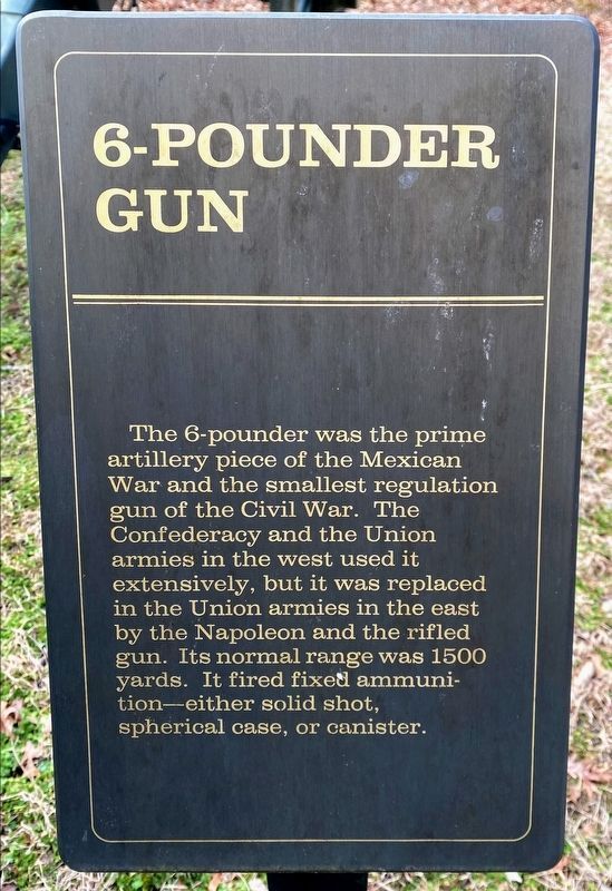
Photographed by Shane Oliver, February 7, 2021
1. 6-pounder Gun Marker
Topics. This historical marker is listed in these topic lists: War, Mexican-American • War, US Civil. A significant historical year for this entry is 1500.
Location. 36° 28.927′ N, 87° 51.821′ W. Marker is in Dover, Tennessee, in Stewart County. It is on Fort Donelson Park Road, on the right when traveling south. Located across the street from the visitor center in the Fort Donelson National Battlefield. Touch for map. Marker is in this post office area: Dover TN 37058, United States of America. Touch for directions.

Regionally, this marker is in Middle Tennessee and in the Highland Rim. It is also in the American South and specifically in the Upper South. Globally, it is in North America, the Western Hemisphere, the Western World, and the Anglosphere. Historically, it finds itself in what was once the territory of the Mississippian Culture, one of the Confederate States of America, and the Antebellum South.
Other nearby markers. At least 8 other markers are within walking distance of this marker: Porter's Battery (a few steps from this marker); Fort Donelson Confederate Monument (approx. 0.2 miles away); Confederate Monument (approx. 0.2 miles away); The Stewart County Iron Industry (approx. 0.3 miles away); Union Camp (approx. 0.3 miles away); Lauman's Brigade (approx. 0.3 miles away); Graves' Battery (approx. 0.3 miles away); Buckner's Division (approx. 0.3 miles away). Touch for a list and map of all markers in
this page online
Other markers no longer nearby. Federal Troops and Casualties at Fort Donelson (was about 300 feet away, measured in a direct line but has been confirmed missing); Confederate Troops and Casualties at Fort Donelson (was about 300 feet away but has been confirmed missing); Fort Donelson (was about 300 feet away but has been confirmed missing); Forrest's Escape (was approx. ¼ mile away but has been permanently removed); Battle of Dover (was approx. 0.3 miles away but has been permanently removed); Morrison's Attack (was approx. 0.3 miles away but has been permanently removed); Holding The Line (was approx. 0.3 miles away but has been permanently removed); Forrest's Attack (was approx. 0.3 miles away but has been permanently removed).
Photographed by Craig Swain, September 4, 2010
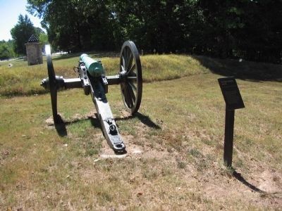
2. 6-pounder Gun and Marker
The 6-pdr Model 1841 next to the marker was produced in 1861 by Cyrus Alger of Boston, Massachusetts. It weighed 887 pounds and was assigned registry number 185, after inspection by T. J. Rodman.
Photographed by Craig Swain, September 4, 2010
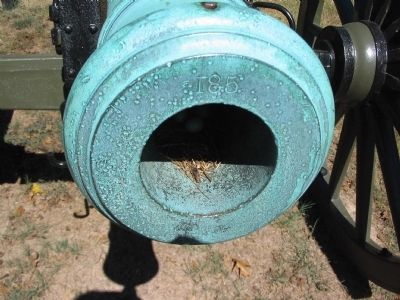
3. Muzzle of Smoothbore 6-pdr
Showing the registry number 185.
Photographed by Craig Swain, September 4, 2010
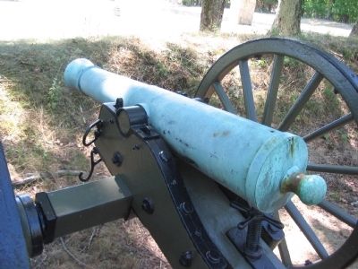
4. Model 1841 6-pounder Gun
A second 6-pdr sits on display closer to the visitor center, on the opposite side of the road from the marker. This piece was produced by Cyrus Alger in 1844. It is registry number 74, weighing 891 pounds. It was inspected by John Wolfe Ripley.
Credits. This page was last revised on May 10, 2021. It was originally submitted on November 15, 2010, by Craig Swain of Leesburg, Virginia. This page has been viewed 1,200 times since then and 39 times this year. Last updated on May 3, 2015, by J. Makali Bruton of Washington, District of Columbia. Photos: 1. submitted on May 10, 2021, by Shane Oliver of Richmond, Virginia. 2, 3, 4. submitted on November 15, 2010, by Craig Swain of Leesburg, Virginia. • Bill Pfingsten was the editor who published this page.
