Fredericksburg, Virginia — The American South (Mid-Atlantic)
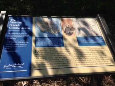
The Vermont Brigade Counterattacks
Fredericksburg: Timeless.
Photographed by Charles T. Harrell, May 3, 2015
1. The Vermont Brigade Counterattacks Marker
On May 4, 1863, Colonel Lewis A. Grant's brigade of Vermont regiments held the ridge to your right front. Late in the day, Brigadier Generals Harry T. Hays and Robert Hoke launched their Louisiana and North Carolina brigades against a Union line at what is now Hugh Mercer School, Colonel Isaac E. Avery stepping in to command the North Carolinians after Hoke fell wounded. When the first Federal line collapsed, the Confederates hastened forward, across this terrain.
The awaiting Federals in a second line lay prone. As their adversaries closed in, the Vermont men rose up and delivered several volleys of musketry. The Confederates fell back and the Federals surged forward in a counterattack that captured hundreds of prisoners. The local success proved short-lived, though, because another Confederate attack gained critical ground near Fall Hill (behind you) and the Federals in this area had to pull back or be captured.
"We waited until the enemy were within twenty feet of our guns, then rose, fired and charged at once with level bayonets."
"the ground was covered with one commingled mass of rebel knapsacks, haversacks, canteens, muskets and equipment, besides the dead and dying...."
-Vermont
this page online
(captions)
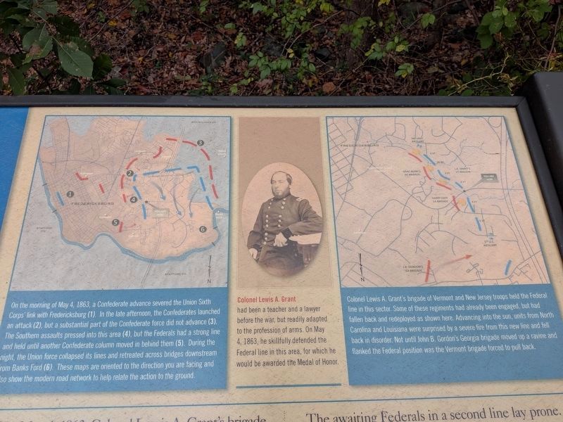
(left map) On the morning of May 4, 1863, a Confederate advance severed the Union Sixth Corps' link with Fredericksburg (1). In the late afternoon, the Confederates launched an attack (2), but a substantial part of the Confederate force did not advance (3). The Southern assaults pressed into this area (4), but the Federals had a strong line and held until another Confederate column moved in behind them (5). During the night, the Union force collapsed its lines and retreated across bridges downstream from Banks Ford (6). These maps are oriented to the direction you are facing, and also show the modern road network to help relate the action to the ground.
(center photo) Colonel Lewis A. Grant had been a teacher and a lawyer before the war, but readily adapted to the profession of arms. On May 4, 1863, he skillfully defended the Federal line in this area, for which he would be awarded the Medal of Honor.
(right map) Colonel Lewis A. Grant's brigade of Vermont and New Jersey troops held the Federal line in this sector. Some of these regiments had already been engaged, but had fallen back and redeployed
Photographed by Evan Dwyer, October 12, 2026
2. The Vermont Brigade Counterattacks Marker
Map Details showing the movements that align with the caption reproduced on this page.
Fredericksburg Timeless
Spotsylvania Stafford Federicksburg
Panel design by Jackson Foster, The I.D. Entity
Erected 2015 by Fredericksburg Economic Development and Tourism Office.
Topics and series. This historical marker is listed in this topic list: War, US Civil. In addition, it is included in the Virginia, Fredericksburg: Timeless. series list. A significant historical month for this entry is May 1686.
Location. 38° 18.354′ N, 77° 29.799′ W. Marker is in Fredericksburg, Virginia. It is on Cowan Boulevard 0.2 miles west of Preserve Lane, on the right when traveling east. Touch for map. Marker is at or near this postal address: 1011 Hotchkiss Ct, Fredericksburg VA 22401, United States of America. Touch for directions.

Regionally, this marker is in the Washington Metropolitan Area and in Northern Virginia. It is also in the American
Photographed by Charles T. Harrell, May 2, 2015
3. The Vermont Brigade Counterattacks Marker
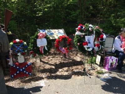
During the dedication of the Historical Marker
Other nearby markers. At least 8 other markers are within walking distance of this marker: The Heights at Smith Run (here, next to this marker); Tactical Terrain (approx. ¾ mile away); The Mannahoac Indigenous Tribe (approx. 0.8 miles away); Freedom, A Work in Progress / Fredericksburg, Virginia (approx. 0.9 miles away); Fredericksburg in a Flash / Byway to Highway (approx. 0.9 miles away); Fredericksburg, Virginia / Area Museums (approx. 0.9 miles away); A Family Affair: The Washingtons / Visitors-in-Chief (approx. 0.9 miles away); Fall Hill Road (approx. 0.9 miles away). Touch for a list and map of all markers in Fredericksburg.
Other markers no longer nearby. Historic Kenmore and George Washington's Ferry Farm (was approx. 0.9 miles away but has been permanently removed); George Washington: Soldier and Virginia Planter
Photographed by Evan Dwyer, October 12, 2026
4. The Vermont Brigade Counterattacks Marker
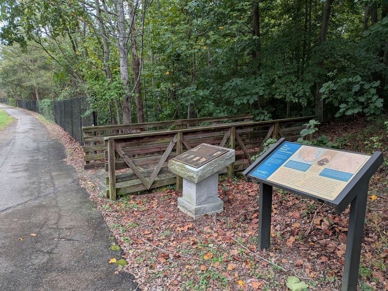
And Sons of Confederate Veterans Monument alongside at the Cowan Boulevard Trailhead. The slope of the hillside behind the marker can be perceived from the railing and traffic bridge that starts crossing the Stream Valley just to the left of the footbridge. The bridge stands about 30' above the stream at its crossing.
Also see . . . Central Virginia Battlefields Trust - Smith Run. This link tells the story of this site's preservation. (Submitted on October 20, 2026, by Evan Dwyer of Richmond, Virginia.)
Internet Archive
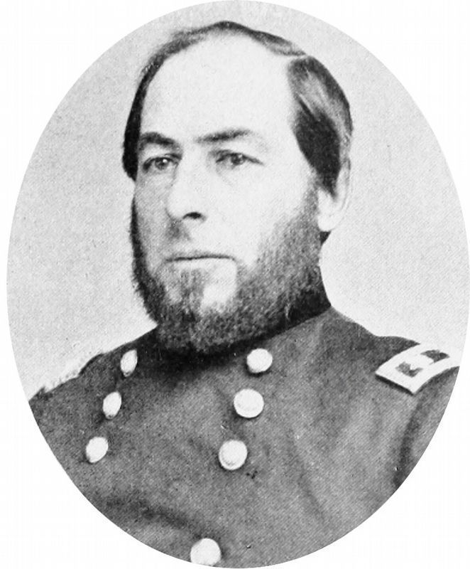
5. Lewis A. Grant
Colonel Lewis A. Grant had been a teacher and a lawyer before the war, but readily adapted to the profession of arms. On May 4, 1863, he skillfully defended the Federal line in this area, for which he would be awarded the Medal of Honor.
Photo from The Photographic History of the Civil War by Francis Trevelyan Miller and Robert S. Lanier, Volume 10, 1911.
Photo from The Photographic History of the Civil War by Francis Trevelyan Miller and Robert S. Lanier, Volume 10, 1911.
Photographed by Evan Dwyer, October 12, 2026
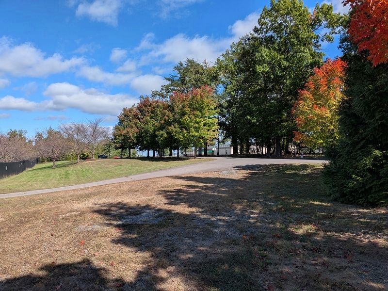
6. Hugh Mercer Elementary School (Federal Initial Position)
This view from the Smith Run Trail trailhead at the school gives some idea of the elevation the Federal first line held before the Confederate assault of 4 May 1863 broke through and surged down the stream valley towards Smith Run.
Photographed by Evan Dwyer, October 12, 2026
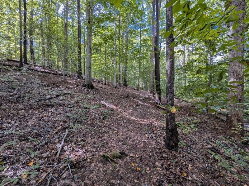
7. The Heights at Smith Run
This view shows the western slope of Smith Run, beneath the heights. The stream itself is out of view to the right. After the Confederates broke the first Federal line on the eastern side of the stream near where Hugh Mercer Elementary now stands, some of the shattered Federal forces retreated across the stream and up to the heights to the left, where the Vermont Brigade under Col. Lewis A. Grant held a second line. The Federals held that elevated position while the Confederates attacked up this slope - then counterattacked and drove them back to the stream, capturing hundreds of Confederates as they went. The 2nd Vermont fought in this particular area.
Photographed by Evan Dwyer, October 12, 2026
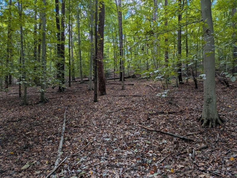
8. Position of the 2nd Vermont
The heights on which the Vermonters perched are visible in the distance here. This view looks up the western slope of the Smith Run stream valley from the Smith Run Trail, just inside the woods from the Cowan Boulevard trailhead.
Credits. This page was last revised on October 20, 2026. It was originally submitted on May 3, 2015, by Charles T. Harrell of Woodford, Virginia. This page has been viewed 1,024 times since then and 40 times this year. Last updated on May 4, 2015, by J. Makali Bruton of Washington, District of Columbia. Photos: 1. submitted on May 3, 2015, by Charles T. Harrell of Woodford, Virginia. 2. submitted on October 20, 2026, by Evan Dwyer of Richmond, Virginia. 3. submitted on May 3, 2015, by Charles T. Harrell of Woodford, Virginia. 4. submitted on October 20, 2026, by Evan Dwyer of Richmond, Virginia. 5. submitted on October 8, 2020, by Allen C. Browne of Silver Spring, Maryland. 6, 7, 8. submitted on October 20, 2026, by Evan Dwyer of Richmond, Virginia. • Andrew Ruppenstein was the editor who published this page.
