Dover in Stewart County, Tennessee — The American South (East South Central)
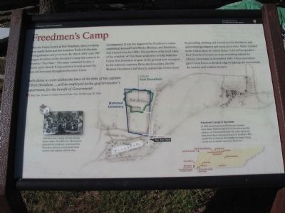
Freedmen's Camp
Photographed by Craig Swain, September 4, 2010
1. Freedmen's Camp Marker
this page online
Such slaves as were within the lines at the time of the capture of Fort Donelson... will be employed in the quartermaster's department, for the benefit of Government.
Brig. Gen. Ulysses S. Grant, General Order No. 14, February 26, 1862
Education was a major priority among former slaves. By 1864 over 100 students attended the freedmen's school at Fort Donelson, which received praise from teachers and military officials alike.
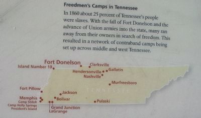
Freedmen's Camps in Tennessee
In 1860 about 25 percent of Tennessee's people were slaves. With the fall of Fort Donelson and the advance of Union armies into the state, many ran away from their owners in search of freedom. This resulted in a network of contraband camps being set up across middle and west Tennessee.
Erected by Fort Donelson National Battlefield - National Park Service - Department of the Interior.
Topics. This historical marker is listed in these topic lists: African Americans • War, US Civil. A significant historical date for this entry is February 14, 1694.
Location. 36° 29.164′ N, 87° 50.823′ W. Marker is in Dover, Tennessee, in Stewart County. It is at the intersection of Cemetery Road and Church
Photographed by Craig Swain, September 4, 2010
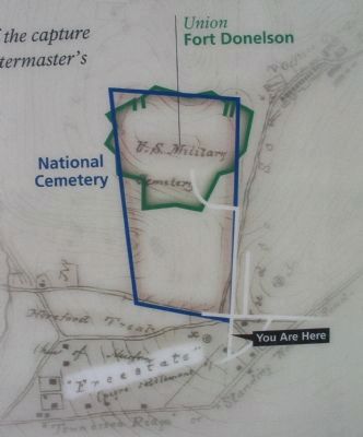
2. Map of the Second Fort Donelson

Regionally, this marker is in Middle Tennessee and in the Highland Rim. It is also in the American South and specifically in the Upper South. Globally, it is in North America, the Western Hemisphere, the Western World, and the Anglosphere. Historically, it finds itself in what was once the territory of the Mississippian Culture, one of the Confederate States of America, and the Antebellum South.
Other nearby markers. At least 8 other markers are within walking distance of this marker: Brandon-Sykes Showboat House (about 400 feet away, measured in a direct line); Hallowed Ground (about 600 feet away); Cemetery Lodge (about 700 feet away); The Battle of Dover/Confederate Mass Grave (approx. 0.2 miles away); Stewart Co. War Memorial (approx. 0.4 miles away); The Spirit of '76 Half Century Time Capsule (approx. 0.4 miles away); French's Battery (approx.
Photographed by Craig Swain, September 4, 2010
3. Freedmen's Camps in Tennessee
Also see . . . Fort Donelson. National Park Service site. (Submitted on December 7, 2010, by Craig Swain of Leesburg, Virginia.)
Photographed by Craig Swain, September 4, 2010
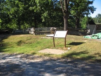
4. Freedmen's Camp Marker
Credits. This page was last revised on May 10, 2021. It was originally submitted on December 7, 2010, by Craig Swain of Leesburg, Virginia. This page has been viewed 1,287 times since then and 32 times this year. Last updated on May 5, 2015, by J. Makali Bruton of Washington, District of Columbia. Photos: 1, 2, 3, 4. submitted on December 7, 2010, by Craig Swain of Leesburg, Virginia. • Andrew Ruppenstein was the editor who published this page.
