Near Blountville in Sullivan County, Tennessee — The American South (East South Central)
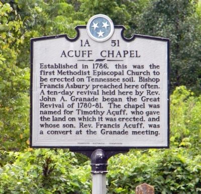
Acuff Chapel
| — | United Methodist Church Historic Shrine | — |
Photographed by Paul Crumlish, July 15, 2011
1. Acuff Chapel Marker
Erected by Tennessee Historical Commission. (Marker Number 1A 51.)
Topics and series. This historical marker is listed in these topic lists: Cemeteries & Burial Sites • Religion & Religious Structures. In addition, it is included in the Francis Asbury, Traveling Methodist Preacher, the Tennessee Historical Commission, and the United Methodist Church Historic Sites series lists. A significant historical year for this entry is 1786.
Location. 36° 32.067′ N, 82° 21.647′ W. Marker is near Blountville, Tennessee, in Sullivan County. It is on Memorial Boulevard (State Road 126) 0.7 miles west of Barr Road, on the right when traveling west. Touch for map. Marker is in this post office area: Blountville TN 37617, United States of America.
this page online

Regionally, this marker is in East Tennessee and in the Tri-Cities Area. It is also in the American South, specifically in the Upper South, in Appalachia, and specifically in Southern Appalachia. Globally, it is in North America, the Western Hemisphere, the Western World, and the Anglosphere. Historically, it finds itself in what was once the original Cherokee Nation, the territory of the Mississippian Culture, one of the Confederate States of America, the State of Franklin, and the Antebellum South.
Other nearby markers. At least 8 other markers are within 2 miles of this marker, measured as the crow flies: Taylor’s Meeting House (approx. 1.2 miles away); Battle of Blountville (approx. 1.6 miles away); James Brigham (approx. 1.9 miles away); a different marker also named Battle of Blountville (approx. 1.9 miles away); Historic Courthouse Bell (approx. 1.9 miles away); Sullivan County (approx. 1.9 miles away); Battle of Blountville Confederate Memorial (approx. 1.9 miles away); a different marker also named Battle of Blountville (approx. 1.9 miles away). Touch for a list and map of all markers
Photographed by Paul Crumlish, July 15, 2011
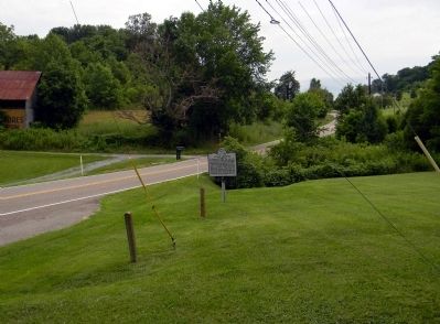
2. Wide view of the Acuff Chapel Marker
Photographed by Paul Crumlish, July 15, 2011
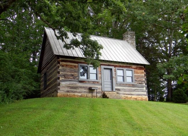
3. Acuff Chapel (1786)
Restored by the Holston Conference Historical Society, in 1962, it contains much of the timber from the original structure.
Photographed by Paul Crumlish, July 15, 2011
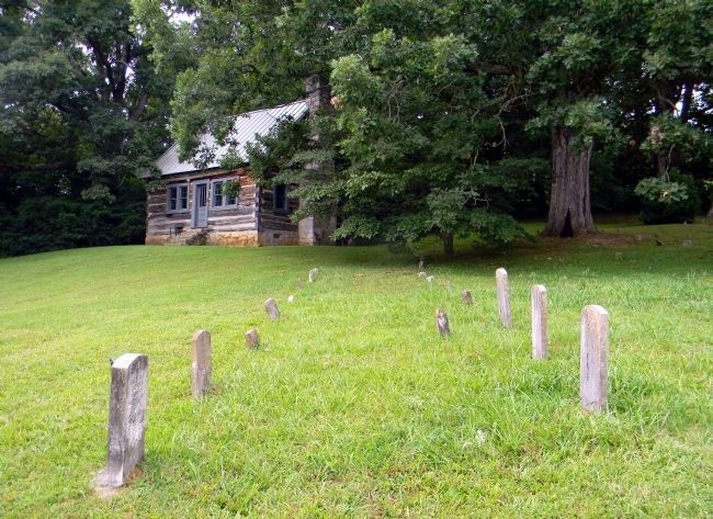
4. Acuff Chapel (1786) and Cemetery
Many of the Acuff family members are buried here including; Timothy (1732-1823) and Rev Francis Acuff.
Credits. This page was last revised on August 20, 2023. It was originally submitted on August 8, 2011, by PaulwC3 of Northern, Virginia. This page has been viewed 2,075 times since then and 128 times this year. Last updated on May 5, 2015, by J. Makali Bruton of Washington, District of Columbia. Photos: 1, 2, 3, 4. submitted on August 8, 2011, by PaulwC3 of Northern, Virginia. • Andrew Ruppenstein was the editor who published this page.
