Near Washtucna in Franklin County, Washington — The American West (Northwest)
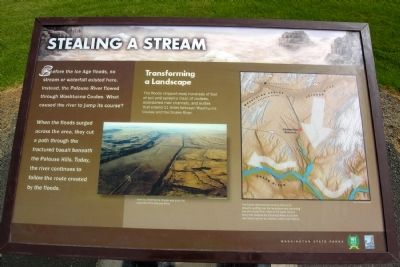
Stealing a Stream
Photographed by Duane Hall, August 28, 2010
1. Stealing a Stream Marker
When the floods surged across the area, they cut a path through the fractured basalt beneath the Palouse Hills. Today, the river continues to follow the route created by the floods.
Transforming a Landscape
The floods stripped away hundreds of feet of soil and carved a maze of coulees, abandoned river channels, and buttes that extend 11 miles between Washtucna Coulee and the Snake River.
(Center Photo Caption)
Now dry, Washtucna Coulee was once the channel of the Palouse River.
(Right Map Caption)
The floods overwhelmed existing rivers and streams, spilling over the landscape and slamming into the Snake River. Most of the water flowed downriver towards the Columbia River, but some was forced upriver to Lewiston, Idaho and beyond.
Erected by Washington State Parks.
Topics. This historical marker is listed in this topic list: Natural Features.
Location. 46° 39.811′ N, 118° 13.649′ W. Marker
this page online

Regionally, this marker is in the Columbia Basin. It is also in the American Mountain West and in the Lewis & Clark Corridor. Globally, it is in North America, on the Pacific Rim, in the Western Hemisphere, in the Western World, and in the Anglosphere.
Other nearby markers. At least 8 other markers are within 5 miles of this marker, measured as the crow flies: Explore Massive Floodscapes! (within shouting distance of this marker); In the Path of Cataclysmic Floods (within shouting distance of this marker); Setting the Stage (within shouting distance of this marker); Overwhelming Proof for an "Outrageous" Theory (within shouting distance of this marker); Small Town, Big Voice (within shouting distance of this marker); Cataclysmic Floods (approx. 4.7 miles away); Floods Reveal the Past
Photographed by Duane Hall, August 28, 2010
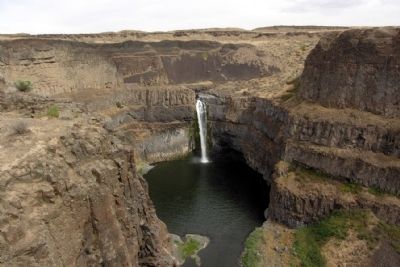
2. Palouse Falls
Also see . . . Palouse Falls - Wikipedia entry. This article also has links to Wikipedia entries on the Columbia River Basalt Group, the Channeled Scablands, and the Missoula Floods. (Submitted on May 6, 2015.)
Photographed by Duane Hall, August 28, 2010
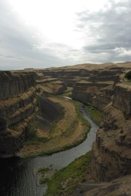
3. Palouse River Canyon South of Palouse Falls
Credits. This page was last revised on June 16, 2016. It was originally submitted on May 6, 2015, by Duane Hall of Abilene, Texas. This page has been viewed 511 times since then and 31 times this year. Photos: 1, 2, 3. submitted on May 6, 2015, by Duane Hall of Abilene, Texas.
Editor’s want-list for this marker. Photo of wide-view of marker and surrounding area. • Can you help?
