Near Washtucna in Franklin County, Washington — The American West (Northwest)
Setting the Stage
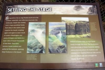
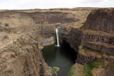
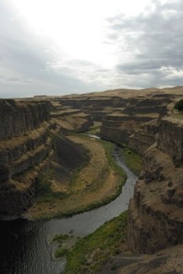
Millions of years later, Ice Age floods swept through this area. The floodwaters took advantage of these fractures, cutting steep chanels where the bedrock was weakest and creating Palouse Falls and its canyon. The floods also changed the course of the river.
(Left Illustration Caption)
During the height of the floods, this entire area was under hundreds of feet of water. This painting shows a flood in progress after the water level dropped several hundred feet.
(Center Illustration Caption)
Palouse Falls today.
(Right Photo Caption)
See the large crack in the basalt cliffs across the canyon? This is one of the fractures in the basalt opened by tectonic forces coming from deep within the earth. Can you see any others?
Erected by Washington State Parks.
Topics. This historical marker is listed in this topic list: Natural Features.
Location. 46° 39.774′ N, 118° 13.653′ W. Marker is near Washtucna, Washington, in Franklin County. Marker can be reached from Palouse Falls Road, 2.4 miles west of Washington Highway 261. Marker is located in Palouse Falls State Park at the end of Palouse Falls Road; a entrance fee may be required. Touch for map. Marker is in this post office area: Washtucna WA 99371, United States of America. Touch for directions.
Other nearby markers. At least 6 other markers are within 5 miles of this marker, measured as the crow flies. Overwhelming Proof for an "Outrageous" Theory (here, next to this marker); Small Town, Big Voice (here, next to this marker); Stealing a Stream (within shouting distance of this marker); Explore Massive Floodscapes! (about 300 feet away, measured in a direct line); In the Path of Cataclysmic Floods (about 300 feet away); M - R Military Road (approx. 4.7 miles away).
Also see . . . Palouse Falls - Wikipedia entry. This article also has links to Wikipedia entries on the Columbia River Basalt Group, the Channeled Scablands, and the Missoula Floods. (Submitted on May 6, 2015.)
Credits. This page was last revised on June 16, 2016. It was originally submitted on May 6, 2015, by Duane Hall of Abilene, Texas. This page has been viewed 296 times since then and 8 times this year. Photos: 1, 2, 3. submitted on May 6, 2015, by Duane Hall of Abilene, Texas.
Editor’s want-list for this marker. Photo of wide-view of marker and surrounding area. • Can you help?


