McMinnville in Warren County, Tennessee — The American South (East South Central)
Cumberland Caverns
Saltpeter Mine
Photographed by Darren Jefferson Clay, February 18, 2023
1. Cumberland Caverns Marker
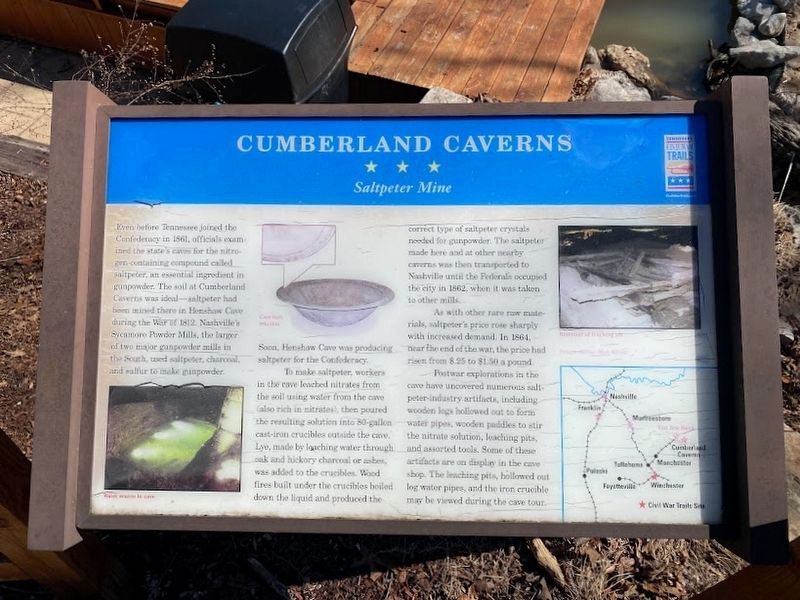
Soon, Henshaw Cave was producing saltpeter for the Confederacy.
To make saltpeter, workers in the cave leached nitrates from the soil using water from the cave (also rich in nitrates), then poured the resulting solution into 80-gallon cast-iron crucibles outside the cave. Lye, made by leaching water through oak and hickory charcoal or ashes, was added to the crucibles. Wood fires built under the crucibles boiled down the liquid and produced the correct type of saltpeter crystals need for gunpowder. The saltpeter made here and at other nearby caverns was then transported to Nashville until the Federals occupied the city in 1862, when it was taken to other mills.
As with other
this page online
Postwar explorations in the cave have uncovered numerous saltpeter-industry artifacts, including wooden logs hollowed out to form water pipes, wooden paddles to stir the nitrate solution, leaching pits, and assorted tools. Some of these artifacts are on display in the cave shop. The leaching pits, hollowed out log water pipes, and the iron crucible may be viewed during the cave tour.
Erected by Tennessee Civil War Trails.
Topics and series. This historical marker is listed in this topic list: War, US Civil. In addition, it is included in the Tennessee Civil War Trails series list. A significant historical year for this entry is 1861.
Location. 35° 39.967′ N, 85° 41′ W. Marker is in McMinnville, Tennessee, in Warren County. It is on Cumberland Caverns Road 0.7 miles north of Ballard Drive, on the right when traveling north. Touch for map. Marker is at or near this postal address: 1437 Cumberland Caverns Road, McMinnville TN 37110, United States of America. Touch for directions.

Regionally,
Photographed by Don Morfe, July 26, 2013
2. Cumberland Caverns Marker
Other nearby markers. At least 8 other markers are within 6 miles of this marker, measured as the crow flies: A different marker also named Cumberland Caverns (a few steps from this marker); Higgenbotham's Cave (approx. 1.6 miles away); Kentucky-Alabama Road (approx. 3.6 miles away); The Birthing Tree (approx. 4 miles away); Forrest's Bivouac (approx. 4.7 miles away); Anthia Brady Hughes (approx. 4.9 miles away); Carl T. Rowan (approx. 4.9 miles away); Charles Faulkner Bryan (approx. 5.1 miles away). Touch for a list and map of all markers in McMinnville.
Also see . . . Cumberland Caverns. (Submitted on October 10, 2013.)
Photographed by Don Morfe, July 26, 2013
3. Cumberland Caverns Marker
Photographed by Don Morfe, July 26, 2013
4. Cumberland Caverns Plaque
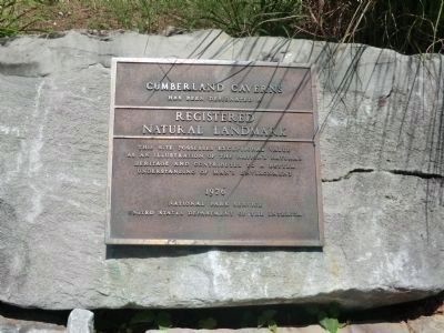
Cumberland Caverns has been designated a Registered Natural Landmark. This site possesses exceptional value as an illustration of the National Natural Heritage and contributes to a better understanding of man's environment. 1976 National Park Service-United States Department of the Interior
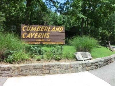
Photographed by Don Morfe, July 26, 2013
5. Cumberland Caverns Sign
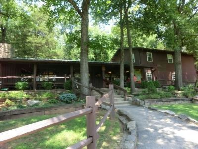
Photographed by Don Morfe, July 26, 2013
6. The Cumberland Caverns shop.
Credits. This page was last revised on April 28, 2023. It was originally submitted on October 10, 2013, by Don Morfe of Baltimore, Maryland. This page has been viewed 1,733 times since then and 52 times this year. Last updated on May 7, 2015, by J. Makali Bruton of Washington, District of Columbia. Photos: 1. submitted on April 28, 2023, by Darren Jefferson Clay of Duluth, Georgia. 2, 3, 4, 5, 6. submitted on October 10, 2013, by Don Morfe of Baltimore, Maryland. • Andrew Ruppenstein was the editor who published this page.
