Collinwood in Wayne County, Tennessee — The American South (East South Central)
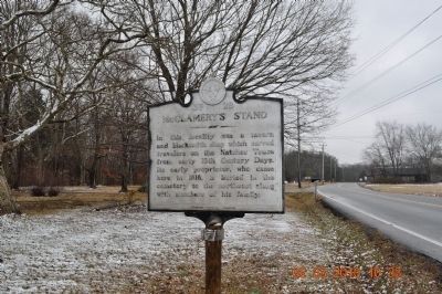
McGlamery's Stand
Erected by Tennessee Historical Commission. (Marker Number 3F28.)
Topics and series. This historical marker is listed in these topic lists: Cemeteries & Burial Sites • Landmarks. In addition, it is included in the Natchez Trace, and the Tennessee Historical Commission series lists. A significant historical year for this entry is 1818.
Location. 35° 8.776′ N, 87° 44.723′ W. Marker is in Collinwood, Tennessee, in Wayne County. Marker is on Tennessee Route 13. On Hwy 13 near Cromwell Crossroads 203 before you get to Collinwood Tn on right. Touch for map. Marker is in this post office area: Collinwood TN 38450, United States of America. Touch for directions.
Other nearby markers. At least 8 other markers are within 12 miles of this marker, measured as the crow flies. McGlamery Stand (approx. 0.2 miles away); Wayne County Veterans Park (approx. 2 miles away); Divided Loyalties (approx. 2 miles away); Sunken Trace (approx. 2.1 miles away); Army of Tennessee (approx. 7.1 miles away); Sweetwater Branch (approx. 8.9 miles away); State Line (approx. 10.7 miles away); Incident at Waynesboro (approx. 12 miles away). Touch for a list and map of all markers in Collinwood.
Also see . . . PRM Radio Segment. Natchez Trace: A Road through the wilderness (Submitted on March 6, 2010, by Sandra Hughes Tidwell of Killen, Alabama, USA.)

Photographed By Sandra Hughes, October 22, 2013
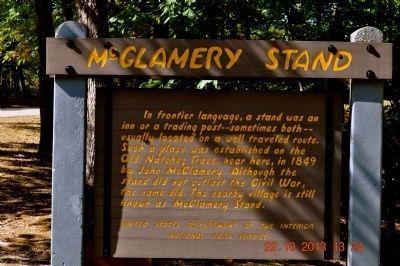
2. McGlamery Stand
In frontier language, a stand was an
inn or a trading post-- sometimes both—
usually located on a well-traveled route.
Such a place was established on the
Old Natchez Trace, near here, in1849
by John McGlamery. Although the
stand did not outlast the Civil War,
the name did. The nearby village is still
known as McGlamery Stand.
United States Department of the Interior
National Park Service
Credits. This page was last revised on June 16, 2016. It was originally submitted on March 4, 2010, by Sandra Hughes Tidwell of Killen, Alabama, USA. This page has been viewed 1,038 times since then and 31 times this year. Last updated on May 12, 2015, by J. Makali Bruton of Accra, Ghana. Photos: 1. submitted on March 4, 2010, by Sandra Hughes Tidwell of Killen, Alabama, USA. 2. submitted on October 23, 2013, by Sandra Hughes Tidwell of Killen, Alabama, USA. • Bernard Fisher was the editor who published this page.
