Kingston, Ontario — Central Canada (North America)
Point Frederick Artillery Battery
Batterie d’artillerie de la Pointe Frederick
Photographed by Barry Swackhamer, August 8, 2014
1. Point Frederick Artillery Battery Marker
Inscription.
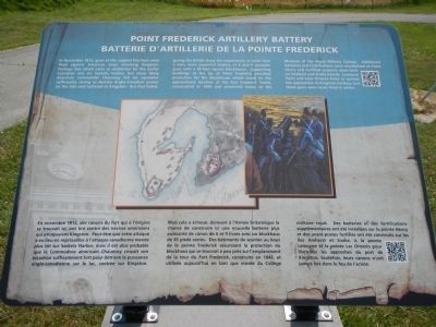
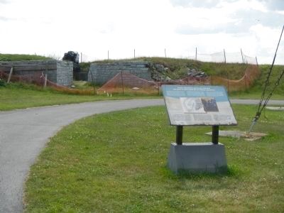
In November 1812, guns of the original fort here were fired against American ships attacking Kingston. Perhaps this attack came as retaliation for the earlier Canadian one on Sackets (sic) Harbor, but more likely American commander Chauncey felt his squadron sufficiently strong to destroy Anglo-Canadian power on the lake and centered at Kingston. But that failed, giving the British Army the opportunity to build here a new, more powerful battery of 6 and 9 pounder guns with a 45-foot square blockhouse. Supporting buildings at the tip of Point Frederick provided protection for the blockhouse which stood on the approximate location of the Fort Frederick Tower, constructed in 1846 and preserved today as the Museum of the Royal Military College. Additional batteries and fortifications were established on Point Henry and fortified outposts were built on Amherst and Snake Islands, Lemoyne Point and Lake Ontario Point to control the approaches to Kingston harbour, but these guns were never fired in action.
French:
En novembre 1812, des canons du fort qui a l’origine se trouvait ici, ont tiré contre des navires américains qui
Click or scan to see this page online
attaquaient Kingston. Peut-être que cette attaque a eu lieu en représailles à l’attaque canadienne menée plus tôt sur Sackets (sic) Harbour, mais il est plus probable que le Commodore américain Chauncey croyait son escadron suffisamment fort pour détruire la puissance anglo-canadienne sur la lac, centrée sur Kingston. Mais cela a échoué, donnant à l’Armée britannique la chance de construite ici une nouvelle batterie plus puissante de canon de 6 et 9 livres avec un blockhaus de 45 pieds carres. Des bâtiments de soutien au bout de la pointe Frederick assuraient la protection du blockhaus qui se trouvait à peu près sur l’emplacement de la tour du Fort Frederick, construite en 1846, et utilisée aujourd’hui en tant que musée du Collége militaire royal. Des batteries et des fortifications supplémentaires ont été installées sur la pointe Henry et des avant-postes fortifiés ont été construits sur les îles Amherst et Snake, à la point Lemoyne et la pointe Lac Ontario pour contrôler les approches du port de Kingston; toutefois, leurs canons n’ont jamais tiré dans le feu de l’action.
Topics. This historical marker is listed in these topic
Location. 44° 13.615′ N, 76° 28.201′ W. Marker is in Kingston, Ontario. It is on Point Frederick Drive, on the right. Marker is at the southern end of Point Frederick, on the Royal Military College of Canada grounds. Touch for map. Marker is in this post office area: Kingston ON K7K 7B4,, Canada. Touch for directions.
Regionally, this marker is in Eastern Ontario and specifically in Southeastern Ontario. It is also in Central Canada. Globally, it is in North America, on the Great Lakes, in the Western Hemisphere, in the Western World, and in the Anglosphere. Historically, it finds itself in what was once a British colony, the Viceroyalty of New France, the Haudenosaunee (Iroquois) Confederacy, and Rupert’s Land.
More about this marker. Kingston is independent from the surrounding Frontenac County.
Credits. This page was last revised on March 27, 2024. It was originally submitted on May 23, 2015, by Barry Swackhamer of Brentwood, California. This page has been viewed 432 times since then and 11 times this year. Photos:1, 2, 3. submitted on May 23, 2015, by Barry Swackhamer of Brentwood, California. • Andrew Ruppenstein was the editor who published this page.