Near Farmville in Prince Edward County, Virginia — The American South (Mid-Atlantic)
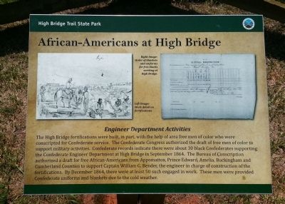
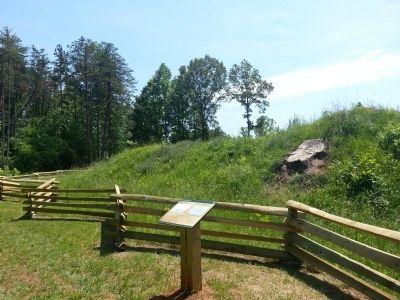
African-Americans at High Bridge
High Bridge Trail State Park
Engineer Department Activities
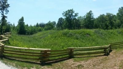
The High Bridge fortifications were built, in part, with the help of area free men of color who were conscripted for Confederate service. The Confederate Congress authorized the draft of free men of color to support military activities. Confederate records indicate there were about 30 black Confederates supporting the Confederate Engineer Department at High Bridge in September 1864. The Bureau of Conscription authorized a draft for free African-Americans from Appomattox, Prince Edward, Amelia, Buckingham and Cumberland Counties to support Captain William G. Bender, the engineer in charge of construction of the fortifications. By December 1864, there were at least 50 such engaged in work. These men were provided Confederate uniforms and blankets due to cold weather.
(captions)
Right image: Order of blankets and uniforms for free blacks working at High Bridge.
Left image: Work detail on fortifications.
Erected by High Bridge Trail State Park.
Topics. This historical marker is listed in these topic lists: African Americans • Forts and Castles • War, US Civil. A significant historical month for this entry is September 1864.
Location. 37° 18.511′ N, 78° 18.904′ W. Marker is near Farmville, Virginia, in Prince Edward County. Marker can be reached from the intersection of River Road (County Route 600) and Jamestown Road (County Route 657), on the left when traveling south. Touch for map. Marker is in this post office area: Rice VA 23966, United States of America. Touch for directions.
Other nearby markers. At least 8 other markers are within 3 miles of this marker, measured as the crow flies. Camp Paradise (within shouting distance of this marker); The High Bridge (about 800 feet away, measured in a direct line); a different marker also named The High Bridge (approx. 0.6 miles away); a different marker also named High Bridge (approx. 1.6 miles away); a different marker also named High Bridge (approx. 2.3 miles away); Cavalry Battle at High Bridge (approx. 2.3 miles away); a different marker also named Cavalry Battle at High Bridge (approx. 2.3 miles away); Rice’s Depot (approx. 2.9 miles away). Touch for a list and map of all markers in Farmville.
Also see . . .
1. High Bridge Trail State Park. Virginia Department of Conservation & Recreation (Submitted on May 24, 2015.)
2. High Bridge. National Register of Historic Places (Submitted on November 11, 2021.)
3. High Bridge. American Battlefield Trust (Submitted on November 11, 2021.)
Credits. This page was last revised on November 11, 2021. It was originally submitted on May 24, 2015, by Bernard Fisher of Richmond, Virginia. This page has been viewed 548 times since then and 24 times this year. Photos: 1, 2, 3. submitted on May 24, 2015, by Bernard Fisher of Richmond, Virginia.


