Richmond Hill in Bryan County, Georgia — The American South (South Atlantic)
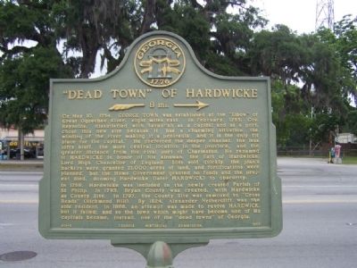
"Dead Town" of Hardwicke
»—8 mi.—→
Photographed by Mike Stroud, May 2008
1. "Dead Town" of Hardwicke Marker
In 1758, Hardwicke was included in the newly created Parish of St. Philip. In 1793,Bryan County was created, with Hardwick as County Site. In 1797, the County Site was removed to "Cross Roads" (Richmond Hill). By 1824, Alexander Netherclift was the sole resident. In 1866, an attempt was made to revive HARDWICK, but it failed; and so the town which might have become one of its capitals
this page online
Erected 1957 by Georgia Historical Commission. (Marker Number 015-8.)
Topics and series. This historical marker is listed in this topic list: Colonial Era. In addition, it is included in the Georgia Historical Society series list. A significant historical date for this entry is May 10, 1754.
Location. 31° 56.975′ N, 81° 18.729′ W. Marker is in Richmond Hill, Georgia, in Bryan County. It is at the intersection of Ford Avenue (State Highway 144) and Coastal Highway (U.S. 17), on the right when traveling east on Ford Avenue. Touch for map. Marker is in this post office area: Richmond Hill GA 31324, United States of America. Touch for directions.

Regionally, this marker is on the Coastal Plain, on the Georgia Coast and the Golden Isles, and in Greater Savannah. It is also in the American South, specifically in the Deep South, and on the Eastern Seaboard. Globally, it is in the North Atlantic Region, North America, the Western Hemisphere, the Western World, and the Anglosphere. Historically, it finds itself in what was once New Spain, the territory of the Mississippian Culture,
Photographed by Mike Stroud, 2008
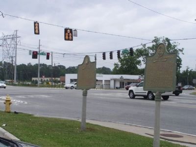
2. "Dead Town" of Hardwicke Marker at the intersection of US 301 and Ga 144
Shares the site with a "Fort McAllister" Historical Marker
Other nearby markers. At least 8 other markers are within walking distance of this marker: Fort McAllister (here, next to this marker); Courthouse Annex (about 400 feet away, measured in a direct line); Ways Station (approx. 0.4 miles away); Richmond Hill Veterans Monument (approx. 0.4 miles away); Jack Fleming Gregory, Senior (approx. half a mile away); a different marker also named Ways Station (approx. half a mile away); J. F. Gregory (approx. half a mile away); Robert E. Lee (approx. half a mile away). Touch for a list and map of all markers in Richmond Hill.
Also see . . . Earl of Hardwicke. A title in the Peerage of Great Britain. It was created in 1754 for Philip Yorke, 1st Baron Hardwicke, Lord Chancellor of Great Britain from 1737 to 1756. (Submitted on June 17, 2008, by Mike Stroud of Bluffton, South Carolina.)
Credits. This page was last revised on October 27, 2024. It was originally submitted on June 17, 2008, by Mike Stroud of Bluffton, South Carolina. This page has been viewed 3,452 times since then and 75 times this year. Photos: 1, 2. submitted on June 17, 2008, by Mike Stroud of Bluffton, South Carolina. • Craig Swain was the editor who published this page.
