Near Port Angeles in Clallam County, Washington — The American West (Northwest)
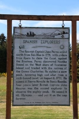
Spanish Explorers
— The Evergreen State —
Erected by the Washington State Highway Commission. (Marker Number 43.)
Topics. This historical marker is listed in these topic lists: Exploration • Natural Features. A significant historical year for this entry is 1774.
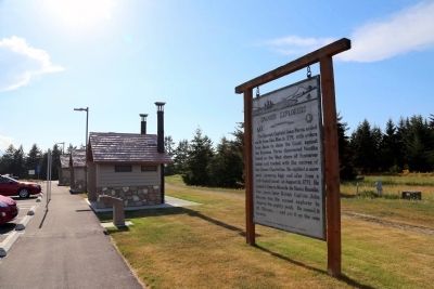
Location. 48° 6.413′ N, 123° 20.876′ W. Marker is near Port Angeles, Washington, in Clallam County. Marker is on U.S. 101 just west of Deer Park Loop, on the right when traveling west. It is at the rest stop. Touch for map. Marker is in this post office area: Port Angeles WA 98362, United States of America. Touch for directions.
Other nearby markers. At least 1 other marker is within 9 miles of this marker, measured as the crow flies. Juan de Fuca (approx. 8.6 miles away).
Also see . . .
1. Juan José Pérez Hernández . Wikipedia entry. “Confident of their territorial claims, the Spanish Empire did not explore or settle the northwest coast of North America in the 250 years after being claimed for the crown by Vasco Núñez de Balboa. By the late 18th century; however, learning of Russian and British arrivals along the Pacific Northwest and Alaskan coasts, Spain finally grew sufficiently concerned about their claims to the region and set out to discover the extent of any colonial Russian and British encroachment.
“In early 1774, the Viceroy of New Spain, Antonio María Bucareli y Ursúa, commanded Pérez to explore the Pacific coast with the objective of reaching 60° north latitude (about the latitude of present day Cordova, Alaska) to discover possible Russian America and British settlements and to re-assert the long-standing Spanish claim to the Pacific Northwest. Rumors of Russian fur traders caused the Spanish to send the frigate Santiago north under the command of Pérez, with a crew mostly from New Spain. Pérez was given explicit instructions to treat all indigenous peoples with respect, and to establish friendly relations with any encountered.
In July 1774, he reached 54°40' north latitude, just off the northwestern tip of Langara Island, one of the Queen Charlotte Islands. There he had an interaction with a group of Haida natives, but he did not go ashore. Due to a lack of provisions and the poor health of his crew, Pérez turned south at this point despite the viceroy's orders to attain 60° north. He reached Nootka Sound on August 7, 1774 (at about 49.6° north latitude), part of today’s Vancouver Island and had an extended set of interactions with the natives, including the first trade of trade goods. Again, he did not go ashore, this time because of bad weather that almost ran his ship aground.
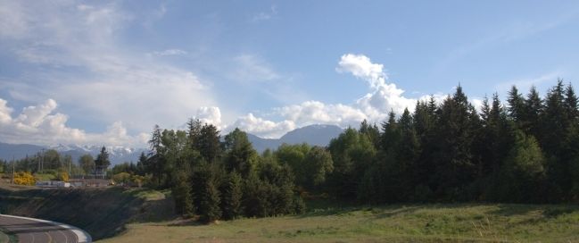
Pérez was accompanied by Fray Juan Crespí and his assistant Fray Tomas de la Pena Y Saravia. Pérez gave the name of Cerro Nevado de Santa Rosalía (‘Snowy Peak of St. Rosalia’) to present day Mount Olympus in the U.S. state of Washington.
“Pérez continued south to the Presidio of Monterey, Las Californias, which he reached on August 28, 1774. After a brief stay, he continued on to reach San Blas on November 5, 1774, thus completing his expedition.” (Submitted on May 24, 2015.)
2. John Meares. Wikipedia entry. “John Meares (c. 1756–1809) was a navigator, explorer, and maritime fur trader, best known for his role in the Nootka Crisis, which brought Britain and Spain to the brink of war.” (Submitted on May 24, 2015.)
Credits. This page was last revised on January 27, 2020. It was originally submitted on May 24, 2015, by J. J. Prats of Powell, Ohio. This page has been viewed 466 times since then and 33 times this year. Photos: 1, 2, 3. submitted on May 24, 2015, by J. J. Prats of Powell, Ohio.


