Islamorada in Monroe County, Florida — The American South (South Atlantic)
Road and Ferry
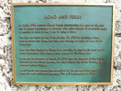
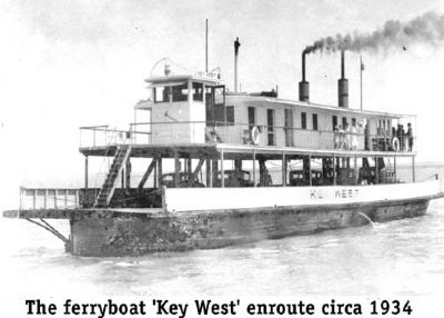
In April, 1926, Monroe County began construction of a road on the east end of Upper Matecumbe to connect with other islands. It eventually made it possible to drive to Key West by using a ferry.
The first car drove to Key West on Jan. 25 1928 by boarding a ferry here at today's Boy Scout Sea Base and crossing 40 miles of water to No Name Key.
Later the ferry docked at Grassy Key, traveling by road to the west end of today's Marathon. From there a ferry crossed to No Name Key.
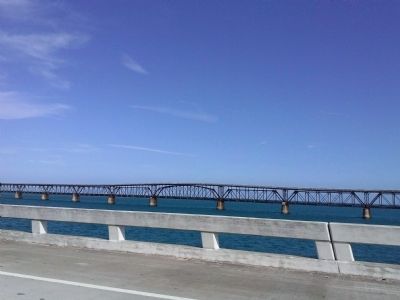
It was on the Morning of March 9, 1938 that the daughter of the Cuban Council cut the ribbon opening the road without the ferries by using the widened railway bridges.
A toll booth was erected here to collect $1 for car and driver and 25 cents for each additional passenger. The toll was removed in 1954.
Topics. This historical marker is listed in these topic lists: Bridges & Viaducts • Roads & Vehicles. A significant historical date for this entry is March 9, 1591.
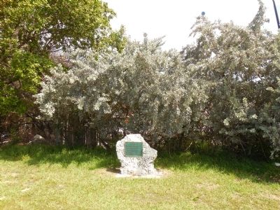
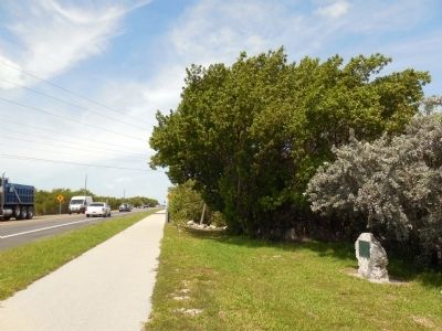
Location. 24° 50.86′ N, 80° 44.586′ W. Marker is in Islamorada, Florida, in Monroe County. Marker is on Overseas Highway, approximately Mile Marker 75, on the right when traveling south. Across Overseas Highway from Calusa Cove Marina. Just north of Anne's Beach Park and Channel #2. Marker is mounted on a coral rock on the side of the road. Touch for map. Marker is in this post office area: Islamorada FL 33036, United States of America. Touch for directions.
Other nearby markers. At least 8 other markers are within 5 miles of this marker, measured as the crow flies. Highway Piers (approx. 0.3 miles away); Site of Camp Three (approx. 0.4 miles away); Tea Table Key (approx. 5 miles away); San Pedro Underwater Archaeological Preserve (approx. 5 miles away); Indian Key Historic State Park (approx. 5 miles away); Triangle of History (approx. 5.1 miles away); Juan Ponce de Leon (approx. 5.1 miles away); Rafters (approx. 5.1 miles away). Touch for a list and map of all markers in Islamorada.
Also see . . .
1. Florida Sea Base, Boy Scouts of America. Website homepage (Submitted on May 31, 2015, by Marsha A. Matson of Palmetto Bay, Florida.)
2. History of the Overseas Highway. Keys History website entry (Submitted on May 31, 2015, by Marsha A. Matson of Palmetto Bay, Florida.)
Credits. This page was last revised on April 23, 2022. It was originally submitted on May 31, 2015, by Marsha A. Matson of Palmetto Bay, Florida. This page has been viewed 396 times since then and 31 times this year. Photos: 1, 2, 3, 4, 5. submitted on May 31, 2015, by Marsha A. Matson of Palmetto Bay, Florida. • Andrew Ruppenstein was the editor who published this page.
