
Near Paint Bank in Craig County, Virginia — The American South (Mid-Atlantic)
Craig County
⎯⎯⎯
West Virginia
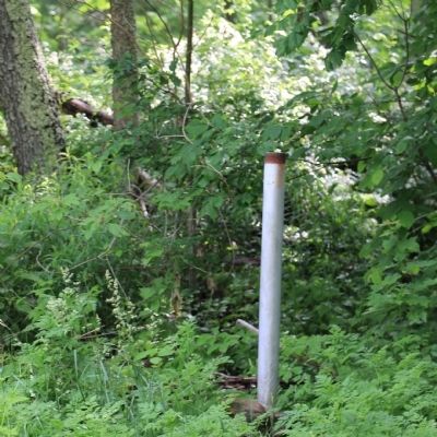
Photographed by J. J. Prats, May 30, 2015
1. Post for the Craig County / West Virginia Marker
Craig County. Area: 333 square miles. Formed in 1851 from Botetourt, Roanoke, Giles, and Monroe. Named for Robert Craig, member of Congress. Craig Healing Springs are in this county.
West Virginia. West Virginia was long a part of Virginia. Morgan Morgan began the settlement of the Region in 1727.A great battle with the Indians took place at Point Pleasant, 1774. West Virginia became a separate state of the union
Erected by Virginia Department of Historic Resources. (Marker Number Z-209.)
Topics and series. This historical marker is listed in these topic lists: Colonial Era • Political Subdivisions • Settlements & Settlers. In addition, it is included in the Virginia Department of Historic Resources (DHR) series list. A significant historical year for this entry is 1851.
Location. Marker is missing. It was located near 37° 36.395′ N, 80° 14.445′ W. Marker was near Paint Bank, Virginia, in Craig County. It was on Virginia Route 311 near the West Virginia State Line, on the right when traveling north. Touch for map. Marker was in this post office area: Paint Bank VA 24131, United States of America.
this page online

Regionally, this marker was in the Mountain Region and in Southwest Virginia. It was also in the American South, specifically in the Upper South, in Appalachia, and specifically in Southern Appalachia. Globally, it was in North America, the Western Hemisphere, the Western World, and the Anglosphere. Historically, it found itself in what was once the territory of the Mississippian Culture, one of the original Thirteen Colonies, one of the Confederate States of America, and the Antebellum South.
Other nearby markers. At least 8 other markers are within 3 miles of this location, measured as the crow flies: West Virginia / Monroe County (approx. 1.4 miles away in West Virginia); Governor John Floyd (approx. 1.4 miles away in West Virginia); Rowan Memorial Home (approx. 1.4 miles away in West Virginia); Gov. John Floyd (approx. 1.4 miles away in West Virginia); Ann Royall / Sweet Springs (approx. 1.6 miles away in West Virginia); Boundary Monument (approx. 2.2 miles away); Governor John Floyd's Grave (approx. 2.2 miles away); Alleghany County / West Virginia (approx. 2.2 miles away).
Credits. This page was last revised on July 6, 2021. It was originally submitted on May 31, 2015, by J. J. Prats of Powell, Ohio. This page has been viewed 481 times since then and 26 times this year. Photo 1. submitted on May 31, 2015, by J. J. Prats of Powell, Ohio. • Bill Pfingsten was the editor who published this page.
Editor’s want-list for this marker. • Photo of marker prior to going missing. • Can you help?
