Swimming Point in Portsmouth, Virginia — The American South (Mid-Atlantic)
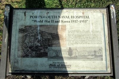
Portsmouth Naval Hospital
“World War II and Korea 1937-1953”
| — | Fort Nelson Park | — |
Photographed by Bernard Fisher, May 30, 2015
1. Portsmouth Naval Hospital Marker
Erected by Path of History, Portsmouth, Va.
Topics. This historical marker is listed in these topic lists: Science & Medicine • War, Korean • War, World II. A significant historical year for this entry is 1941.
Location. 36° 50.492′ N, 76° 18.333′ W. Marker is in Portsmouth, Virginia. It is in Swimming Point. It can be reached from the intersection of Effingham Street and Crawford Parkway, on the right when traveling north. Touch for map. Marker is in this post office area: Portsmouth VA 23704, United States of
this page online

Regionally, this marker is in Virginia’s Hampton Roads, specifically in Coastal Virginia, and in the Hampton Roads Metropolitan Area. It is also in the American South, specifically in the Upper South, in the Tidewater, and on the Eastern Seaboard. Globally, it is in the North Atlantic Region, North America, the Western Hemisphere, the Western World, and the Anglosphere. Historically, it finds itself in what was once the territory of the Mississippian Culture, one of the original Thirteen Colonies, one of the Confederate States of America, and the Antebellum South.
Other nearby markers. At least 8 other markers are within walking distance of this marker: A different marker also named Portsmouth Naval Hospital (a few steps from this marker); a different marker also named Portsmouth Naval Hospital (within shouting distance of this marker); a different marker also named Portsmouth Naval Hospital (within shouting distance of this marker); a different marker also named Portsmouth Naval Hospital (within shouting distance of this marker); Lincolnsville (within shouting distance of this marker);
Photographed by Bernard Fisher, May 30, 2015
2. Portsmouth Naval Hospital Marker
Credits. This page was last revised on February 1, 2023. It was originally submitted on May 31, 2015, by Bernard Fisher of Richmond, Virginia. This page has been viewed 549 times since then and 28 times this year. Photos: 1, 2. submitted on May 31, 2015, by Bernard Fisher of Richmond, Virginia.
