Elgin in Lauderdale County, Alabama — The American South (East South Central)
Elgin/Elgin Crossroads
Photographed by Sandra Hughes, October 7, 2013
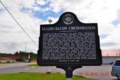
1. Elgin/Elgin Crossroads Marker (side 1)
Settlement of this area began in the early 1800s. Gabriel Butler settled approximately two miles northwest of here on Bluewater Creek. His name is found on the 1810 petition for removal of white settlers leasing land on Chief Doublehead’s Reserve. Gabriel Butler built a Baptist Church on his property which is believed to be the first church in the area. Other early landowners were John Bradford, Daniel White, Walter West, Robert Jackson, Aristides Jackson, Benjamin Ingram, George Ingram, and Moses Ingram. Huntsville Road (Highway 72) and Bellevue Road (Highway 101) was an important intersection. Huntsville Road was a major route from Chattanooga through Florence to Memphis. Bellevue Road led from a natural port on the Tennessee River called Dutch Landing, north to the Military Road near Loretto, Tennessee. Both roads brought much-needed supplies to the early settlers of Elgin and provided routes for them to sell and trade their farm goods. This community has been known as Ingrams Crossroads, Crittendens Crossroads, Crossroads, Elgin Crossroads, and Elgin. The first post office, named Marmion, was established in
this page online
Photographed by Sandra Hughes, October 7, 2013
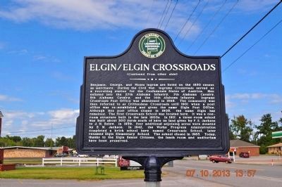
2. Elgin/Elgin Crossroads Marker (side 2)
Erected by East Lauderdale Historical Society.
Topics and series. This historical marker is listed in these topic lists: Settlements & Settlers • War, US Civil. In addition, it is included in the Postal Mail and Philately series list. A significant historical year for this entry is 1810.
Location. 34° 51.045′ N, 87° 23.467′ W. Marker is in Elgin, Alabama, in Lauderdale County. It is at the intersection of Alabama Route 101 and Putnam Parkway, on the left when traveling north on Alabama Route 101. Touch for map. Marker is at or near this postal address: 2743 Highway 101, Rogersville AL 35652, United States of America. Touch for directions.

Regionally, this marker is in North Alabama and in the Shoals. It is also in the American South, specifically in the Deep South, in Appalachia, and specifically in Southern Appalachia. Globally, it is in North America, a Gulf of Mexico state, the Western Hemisphere, the Western World, and the Anglosphere. Historically, it finds itself
Photographed by Sandra Hughes, October 7, 2013
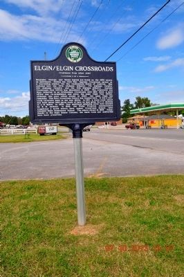
3. Elgin/Elgin Crossroads Marker
Marker is in front of Elgin United Methodist Church.
Other nearby markers. At least 8 other markers are within 3 miles of this marker, measured as the crow flies: Daniel White (approx. 1.2 miles away); Covington/Second Creek / Wheeler Dam/Lake (approx. 1.2 miles away); Cherokee Chief Doublehead's Village Around 1800 (approx. 1.2 miles away); Gabriel “Old Gabe” Butler (approx. 2 miles away); Gabriel Butler Cemetery (approx. 2 miles away); Wheeler Dam / Wheeler Reservoir/Locks (approx. 2½ miles away); Jesse James Gang Canal Payroll Robbery / Trial of Frank James (approx. 2½ miles away); Springfield Community / Springfield Church and School (approx. 2.6 miles away). Touch for a list and map of all markers in Elgin.
Credits. This page was last revised on June 16, 2016. It was originally submitted on October 10, 2013, by Sandra Hughes Tidwell of Killen, Alabama, USA. This page has been viewed 2,618 times since then and 120 times this year. Last updated on May 31, 2015, by J. Makali Bruton of Washington, District of Columbia. Photos: 1, 2, 3. submitted on October 10, 2013, by Sandra Hughes Tidwell of Killen, Alabama, USA. • Bill Pfingsten was the editor who published this page.
