East Hampton in Middlesex County, Connecticut — The American Northeast (New England)
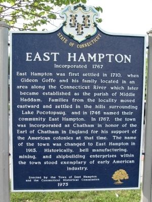
East Hampton
Incorporated 1767
Erected by the Town of East Hampton
and the Connecticut Historical Commission
1975
Erected 1975 by Town of East Hampton, Connecticut Historical Commission.
Topics. This historical marker is listed in these topic lists: Colonial Era • Settlements & Settlers. A significant historical year for this entry is 1767.
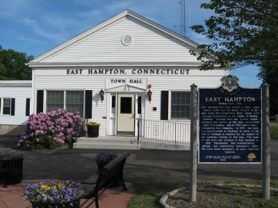
Location. 41° 35′ N, 72° 30.204′ W. Marker is in East Hampton, Connecticut, in Middlesex County. Marker is at the intersection of East High Street (U.S. 66) and North Main Street, on the left when traveling west on East High Street. Located in front of East Hampton Town Hall. Touch for map. Marker is at or near this postal address: 20 East High Street, East Hampton CT 06424, United States of America. Touch for directions.
Other nearby markers. At least 8 other markers are within 7 miles of this marker, measured as the crow flies. Comstock Covered Bridge (approx. 3˝ miles away); Marlborough Veterans Memorial (approx. 4 miles away); Marlborough (approx. 4 miles away); Marlborough Veterans Monument (approx. 4.1 miles away); East Haddam Persian Gulf War Monument (approx. 6.2 miles away); Soldiers' Memorial (approx. 6.2 miles away); East Haddam Veterans Memorial (approx. 6.2 miles away); Roll of Honor (approx. 6.2 miles away).
Also see . . . East Hampton, Connecticut on Wikipedia. (Submitted on June 2, 2015, by Michael Herrick of Southbury, Connecticut.)
Credits. This page was last revised on February 10, 2023. It was originally submitted on June 2, 2015, by Michael Herrick of Southbury, Connecticut. This page has been viewed 461 times since then and 18 times this year. Photos: 1, 2. submitted on June 2, 2015, by Michael Herrick of Southbury, Connecticut.

