Covington, Virginia — The American South (Mid-Atlantic)
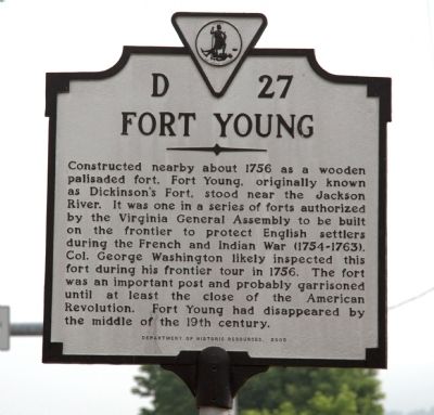
Fort Young
Erected 2003 by Department of Historic Resources. (Marker Number D-27.)
Topics and series. This historical marker is listed in this topic list: War, French and Indian. In addition, it is included in the Former U.S. Presidents: #01 George Washington, the George Washington Slept Here, and the Virginia Department of Historic Resources (DHR) series lists. A significant historical year for this entry is 1756.
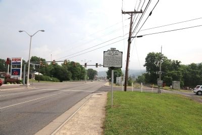
Location. 37° 46.618′ N, 79° 59.483′ W. Marker is in Covington, Virginia. Marker is at the intersection of South Durant Road (Virginia Route 154) and West Riverview Drive and West Parklin Drive, on the left when traveling south on South Durant Road. It is across from the gas station. Touch for map. Marker is in this post office area: Covington VA 24426, United States of America. Touch for directions.
Other nearby markers. At least 8 other markers are within 6 miles of this marker, measured as the crow flies. Alleghany County Confederate Soldiers Monument (approx. 1.1 miles away); Alleghany's Heroic Dead (approx. 1.1 miles away); Alleghany's Heroic Dead. (approx. 1.1 miles away); a different marker also named Alleghany's Heroic Dead (approx. 1.1 miles away); Averellís Salem Raid (approx. 1.4 miles away); Humpback Bridge (approx. 3Ĺ miles away); The Road to the Kanawha (approx. 5.6 miles away); Low Moor Iron Company Coke Ovens (approx. 6 miles away). Touch for a list and map of all markers in Covington.
Credits. This page was last revised on June 16, 2016. It was originally submitted on June 3, 2015, by J. J. Prats of Powell, Ohio. This page has been viewed 1,039 times since then and 78 times this year. Photos: 1, 2. submitted on June 3, 2015, by J. J. Prats of Powell, Ohio.

