
Union Canal Company of Pennsylvania
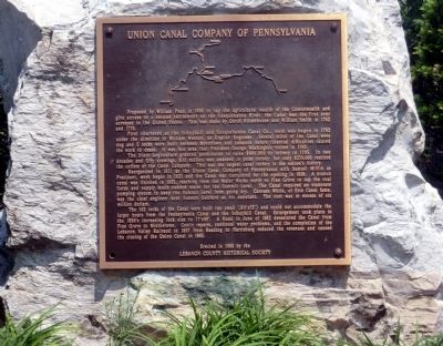
First charted as the Schuylkill and Susquehanna Canal Co., work was begun in 1792 under the direction of William Weston, an English Engineer. Several miles of the Canal were dug and 5 locks were built between Myerstown and Lebanon before financial difficulties caused the work to cease. It was this area that President George Washington visited in 1793.
The State Legislature granted permission to raise $400,000 by lottery in 1795. In two decades and fifty drawings, $33 million was awarded in prize money; but only $270,000 reached the coffers of the Canal Company. This was the largest canal lottery in the nation’s history.
Reorganized in 1811 as the Union Canal Company of Pennsylvania with Samuel Mifflin as President, work began in 1821 and the Canal was completed for the opening in 1828. A branch canal was finished in 1832, reaching from the Water
this page online
The 102 locks of the Canal were built too small (8 ½’ x 75’) and could not accommodate the larger boats from the Pennsylvania Canal and the Schuylkill Canal. Enlargement took place in the 1850’s increasing lock size to 17’x90’. A flood in June of 1862 devastated the Canal from Pine Grove to Middletown. Costly repairs, continual water problems, and the completion of the Lebanon Valley Railroad in 1857 from Reading to Harrisburg reduced the revenues and caused the closing of the Union Canal in 1885.
Erected 1988 by Lebanon County Historical Society.
Topics and series. This historical marker is listed in this topic list: Waterways & Vessels. In addition, it is included in the Union Canal series list. A significant historical month for this entry is June 1862.
Location. 40° 20.894′ N, 76° 27.386′ W. Marker is
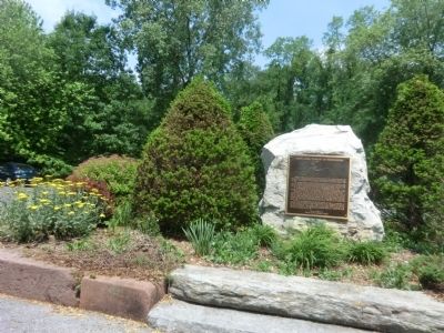

Regionally, this marker is in South-Central Pennsylvania, specifically in Pennsylvania Dutch Country, and in Greater Harrisburg. It is also in the American Northeast, in the Mid-Atlantic, in Appalachia, and specifically in Northern Appalachia. Globally, it is in North America, the Western Hemisphere, the Western World, and the Anglosphere. Historically, it finds itself in what was once the Haudenosaunee (Iroquois) Confederacy and also one of the original Thirteen Colonies.
Other nearby markers. At least 8 other markers are within 2 miles of this marker, measured as the crow flies: Union Canal Tunnel (here, next to this marker); a different marker also named Union Canal Tunnel (approx. ¼ mile away); Tomb of the Unknown Soldier (approx. half a mile away); Remembering the Men and Women (approx. 0.6 miles away); Cleona (approx. 0.7 miles away);
Credits. This page was last revised on June 16, 2016. It was originally submitted on June 8, 2015, by Don Morfe of Baltimore, Maryland. This page has been viewed 795 times since then and 30 times this year. Photos: 1, 2, 3, 4. submitted on June 8, 2015, by Don Morfe of Baltimore, Maryland. • Bill Pfingsten was the editor who published this page.
