Rogersville in Lauderdale County, Alabama — The American South (East South Central)
Samuel Burney: 1763-1849 Revolutionary War Veteran
⎯⎯⎯
Burneys Creek/First Creek Wheeler Lake
Photographed by Sandra Hughes, December 25, 2014
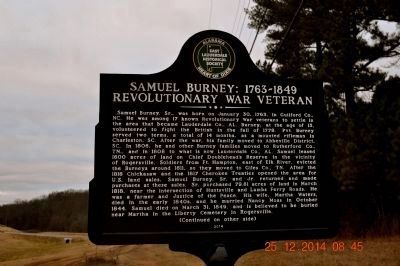
1. Samuel Burney: 1763-1849 marker
(side 1)
Samuel Burney: 1763-1849
Revolutionary War Veteran
Samuel Burney, Sr., was born on January 30, 1763, in Guilford Co., NC. He was among 17 known Revolutionary War veterans to settle in the area that became Lauderdale Co., AL. Burney, at the age of 15, volunteered to fight the British in the fall of 1778. Pvt. Burney served two terms, a total of 14 months, as a mounted rifleman in Charleston, SC. After the war, his family moved to Abbeville District, SC. In 1806, he and other Burney families moved to Rutherford Co., TN., and in 1808 to what is now Lauderdale Co., AL. Samuel leased 1600 acres of land on Chief Doublehead’s Reserve in the vicinity of Rogersville. Soldiers from Ft. Hampton, east of Elk River, evicted the Burneys around 1811, so they moved to Giles Co., TN. After the 1816 Chickasaws and the 1817 Cherokee Treaties opened the area for U.S. land sales, Samuel Burney, Sr. and Jr. returned and made purchases at these sales. Sr. purchased 79.81 acres of land in March 1818, near the intersection of Huntsville and Lambs Ferry Roads. He was a farmer and Justice of the Peace. His wife, Martha Waters, died
this page online
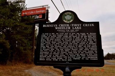
Burneys Creek/First Creek
Wheeler Lake
Photographed by Sandra Hughes, December 25, 2014
2. Burneys Creek/First Creek Wheeler Lake marker
Erected 2014 by East Lauderdale Historical Society.
Topics. This historical marker is listed in these topic lists: Settlements & Settlers • War, US Revolutionary • Waterways & Vessels. A significant historical month for this entry is January 1807.
Location. 34° 49.933′ N, 87° 19.187′ W. Marker is in Rogersville, Alabama, in Lauderdale County. It is at the intersection of Lee Highway (U.S. 72) and County Route 66, on the right when traveling west on Lee Highway. Touch for map. Marker is in this post office area: Rogersville AL 35652, United States of America. Touch for directions.

Regionally, this marker is in North Alabama and in the Shoals. It is also in the American South, specifically in the Deep South, in Appalachia, and specifically in Southern Appalachia. Globally, it is in North
Photographed by Sandra Hughes, December 25, 2014
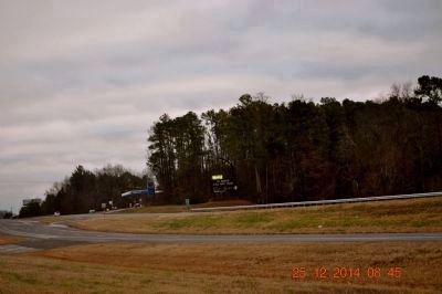
3. Samuel Burney: 1763~1849/Burneys Creek/First Creek Wheeler Lake
Marker is located just a few feet from the entrance to Joe Wheeler State Park
Other nearby markers. At least 8 other markers are within 2 miles of this marker, measured as the crow flies: Camp Drake Boy Scout Camp / Joe Wheeler State Park Negro Area (approx. 0.7 miles away); Return of a Native (approx. ¾ mile away); Bettie Anne Highway (approx. 1.1 miles away); Liberty Church / Liberty Cemetery (approx. 1.2 miles away); Rogersville Presbyterian Church in the U.S.A. (approx. 1.4 miles away); Heritage Park (approx. 1½ miles away); Lamb’s Ferry Road (approx. 1½ miles away); General Joseph Wheeler (approx. 1½ miles away). Touch for a list and map of all markers in Rogersville.
Also see . . . Samuel Burney Grave site. In the early 1800s in the little sleepy town of Rogersville, Alabama resided one of its earliest settlers and American Revolutionary War veteran, Samuel Burney, Sr. (Submitted on December 27, 2014, by Sandra Hughes Tidwell of Killen, Alabama, USA.)
Photographed by Sandra Hughes, December 25, 2014
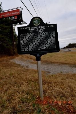
4. Samuel Burney: 1763~1849/Burneys Creek/First Creek Wheeler Lake
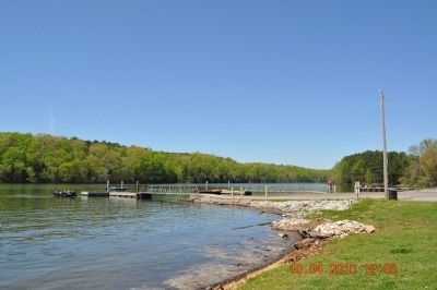
Photographed by Sandra Hughes, April 10, 2010
5. Wheeler Lake
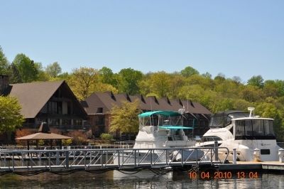
Photographed by Sandra Hughes, April 10, 2010
6. Joe Wheeler Lodge and Marina
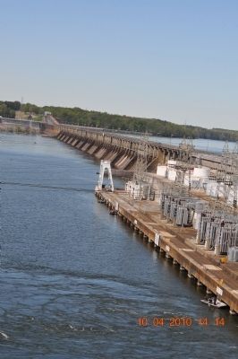
Photographed by Sandra Hughes, April 10, 2010
7. Wheeler Dam
Credits. This page was last revised on August 11, 2020. It was originally submitted on December 27, 2014, by Sandra Hughes Tidwell of Killen, Alabama, USA. This page has been viewed 3,721 times since then and 151 times this year. Last updated on June 12, 2015, by J. Makali Bruton of Washington, District of Columbia. Photos: 1, 2, 3, 4, 5, 6, 7. submitted on December 27, 2014, by Sandra Hughes Tidwell of Killen, Alabama, USA. • Bill Pfingsten was the editor who published this page.
