Dunkirk in Chautauqua County, New York — The American Northeast (Mid-Atlantic)
Eastern Basin Shipwrecks
A Watery Record of Mishaps
— Maritime Heritage —
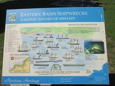
Resting on the Lake Bottom. Beneath the waters before you lies a graveyard of shipwrecks from two centuries. Surprise storms, unchartered shallows, and lack of navigation aids are a few reasons for the wrecks. More and more people are learning to dive so they can explore this underwater exhibit of maritime history.
Some Shipwrecks in the Erie Eastern Basin. These are some of the ships that now rest on the bottom of the lake, shown as they were before the mishap that sunk them.
Wilma, Tug, Depth - 75'
Swallow, Wood Propeller, Depth - 190'
Abyssinia, Wood Schooner/Barge, Depth - 30'
Atlantic, Sidewheel Steamer, Depth - 155'
Cracker, Scow, Depth - 190'
Trade Wind, Bark, 3 Masts, Depth - 120',
St. James, Schooner, 2 Masts, Depth - 164'
Persian, Wood Propeller, 4 Masts, Depth - 195'
C.B. Benson, Barquentine, 3 Masts, Depth - 86'
Brunswick, Iron Propeller, 4 Masts, Depth - 100'
Carlingford, 3 - Masted Schooner, Depth - 95'
Passaic, Propeller Package Freighter, Depth - 80'
Washington Irving, Schooner, 2 Masts, Depth - 120'
Annabell Wilson, 3 - Masted Schooner, Depth 50'
Why and When Did They Go Down?
1936 Wilma - Cut by Ice
1917 Abyssinia - Ran Aground
1913 Annabell Wilson - Storm
1901 Swallow - Storm
1893 Dean Richmond - Storm
1893 C.B. Benson - Storm
1893 Washington Irving - Unknown
1891 Passaic - Storm
1881 Brunswick - Collision with Carlingford
1881 Carlingford - Collision with Brunswick
1875 Persian - Fire
1870 St. James - Unknown
1854 Trade Wind - Collision
1852 Atlantic - Collision
Annabell Wilson
Lost: July 12, 1913
Type: Schooner, 3 masts
Cargo: Coal
Dimensions: 174' x 32'2" x 12'
Cause: Storm
This wreck lies in 50' of water just 1/2 mile off Dunkirk Harbor.
Dive the Seaway Trail. Follow the "Dive the Seaway Trail" signs to some of the northeast's finest diving sites. For more information contact Seaway Trail 315.646.1000, or NY Sea Grant 315.312.3042
History can be revealed by exploring below Seaway Trail waters.
Seaway Trail, Inc., Corner Ray & West Main St., Sackets Harbor, NY 13685; 1-800-SEAWAY-T. America's Byways. This exhibit made possible by a grant from FHWA to Seaway Trail, Inc.
Erected by Seaway Trail, Inc.
Topics and series. This historical marker is listed in these topic lists: Disasters • Waterways & Vessels. In addition, it is included in the Great Lakes Seaway Trail National Scenic Byway, and the Lost at Sea series lists. A significant historical year for this entry is 1852.
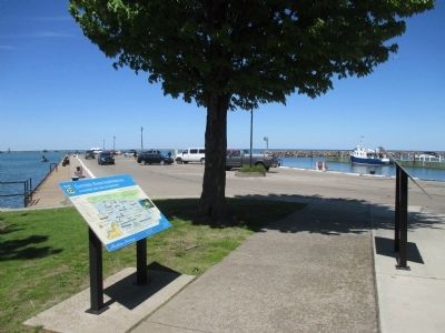
Location. 42° 29.316′ N, 79° 20.171′ W. Marker is in Dunkirk, New York, in Chautauqua County. Marker is on Central Avenue, 0.1 miles north of Lake Shore Drive West (New York State Route 5), on the left when traveling north. Marker is behind a comfort station at the Central Avenue pier. Touch for map. Marker is in this post office area: Dunkirk NY 14048, United States of America. Touch for directions.
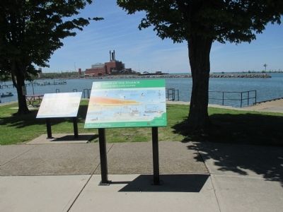
Other nearby markers. At least 8 other markers are within walking distance of this marker. Birds of the Harbor (here, next to this marker); To All That Served Honorably (approx. 0.2 miles away); War on Terrorism Memorial (approx. 0.2 miles away); Disabled American Veterans Memorial (approx. 0.2 miles away); In Honor of Those Who Served (approx. 0.2 miles away); POW★MIA (approx. 0.2 miles away); Dedicated 1975 (approx. 0.2 miles away); Cdr. Harry B. Lyon D.D.S. (approx. 0.2 miles away). Touch for a list and map of all markers in Dunkirk.
Related marker. Click here for another marker that is related to this marker. Anchor from the Annabell Wilson
Credits. This page was last revised on June 16, 2016. It was originally submitted on June 15, 2015, by Anton Schwarzmueller of Wilson, New York. This page has been viewed 559 times since then and 36 times this year. Photos: 1, 2, 3, 4. submitted on June 15, 2015, by Anton Schwarzmueller of Wilson, New York.


