Delta in Madison Parish, Louisiana — The American South (West South Central)
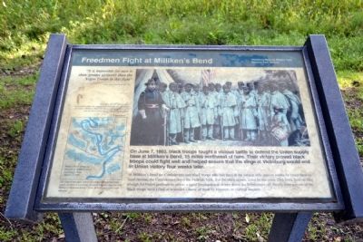
Freedmen Fight at Milliken's Bend
At Millikenís Bend the Confederates met black troops who had been in the service only days or weeks. In brutal hand-to-hand combat, the Confederates drove the Federals back. But the black troops, aided by the white 23rd Iowa, held on long enough for Union gunboats to arrive; a naval bombardment in turn drove the Southerners off. Nearly forty percent of the black troops were killed or wounded – many of them by bayonets or clubbed muskets.
“It is impossible for men to show greater gallantry than the Negro Troops in this fight”
- Brig. Gen. Elias S. Dennis, USA
(Drawing Caption)
More than 180,000 black troops – most of them under the command of white officers – fought for the Union. Millikenís Bend was the second engagement of the war in which United States Colored Troops fought.
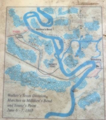
(Map Caption)
The Confederate plan: relieve Vicksburg by crippling Union supply facilities in Louisiana. Southern brigades attacked both Millikenís Bend and Youngís Point. At both places they were defeated.
Erected by National Park Service.
Topics. This historical marker is listed in these topic lists: African Americans • War, US Civil. A significant historical month for this entry is June 1825.
Location. 32° 19.246′ N, 90° 55.977′ W. Marker is in Delta, Louisiana, in Madison Parish. Marker can be reached from the intersection of Old Highway 80 East and Stafford Drive, on the left when traveling south. Marker is located in the Grantís Canal unit of the Vicksburg National Military Park; the above directions are to the parking lot. Touch for map. Marker is in this post office area: Delta LA 71233, United States of America. Touch for directions.
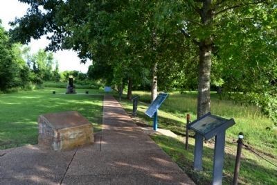
Other nearby markers. At least 8 other markers are within walking distance of this marker. U.S. African Brigade (a few steps from this marker); Grant's Canal Ė 1863 (a few steps from this marker); Ninth Regiment Connecticut Volunteers (a few steps from this marker); U.S. Operations Against Vicksburg (a few steps from this marker); Grant's Canal (a few steps from this marker); Mississippi Sidestep (a few steps from this marker); a different marker also named Grant's Canal (a few steps from this marker); Williams' Canal Ė 1862 (a few steps from this marker). Touch for a list and map of all markers in Delta.
Also see . . . Battle of Milliken's Bend, June 7, 1863. From the National Park Service
website for Vicksburg National Military Park. (Submitted on June 17, 2015.)
Credits. This page was last revised on February 17, 2017. It was originally submitted on June 17, 2015, by Duane Hall of Abilene, Texas. This page has been viewed 714 times since then and 39 times this year. Photos: 1, 2, 3, 4. submitted on June 17, 2015, by Duane Hall of Abilene, Texas.


