Near Rockdale in Milam County, Texas — The American South (West South Central)
Site of the Mission Nuestra Señora de la Candelaria
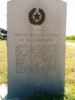
Photographed by Gregory Walker, June 10, 2015
1. Mission Nuestra Señora de la Candelaria Marker
Erected 1936 by State of Texas. (Marker Number 7988.)
Topics and series. This historical marker is listed in these topic lists: Indigenous Peoples and Communities • Religion & Religious Structures • Settlements & Settlers. In addition, it is included in the El Camino Real de los Tejas National Historic Trail, and the Texas 1936 Centennial Markers and Monuments series lists. A significant historical year for this entry is 1749.
Location. 30° 41.245′ N, 97° 7.209′ W. Marker is near Rockdale, Texas, in Milam County. It is on County Road 432 0.2 miles south of Farm to Market Road 908, on the left when traveling south. Touch for map.
this page online

Regionally, this marker is in the Prairies & Lakes Region. It is also in the American South. Globally, it is in North America, a Gulf of Mexico state, the Western Hemisphere, the Western World, and the Anglosphere. Historically, it finds itself in what was once New Spain, the Republic of Texas, one of the Confederate States of America, and the Antebellum South.
Other nearby markers. At least 8 other markers are within 5 miles of this marker, measured as the crow flies: Site of Mission San Francisco Xavier de Los Dolores (approx. half a mile away); Apache Pass River Crossing (approx. one mile away); Worley Bridge (approx. one mile away); Site of the Mission San Ildefonso (approx. 1.8 miles away); Locklin Cemetery (approx. 4.2 miles away); Sharp Cemetery (approx. 4.4 miles away); William Persky (approx. 4½ miles away); San Gabriel Christian Church (approx. 4.6 miles away). Touch for a list and map of all markers in Rockdale.
Also see . . . Nuestra Señora de la Candelaria Mission article at Handbook of Texas.
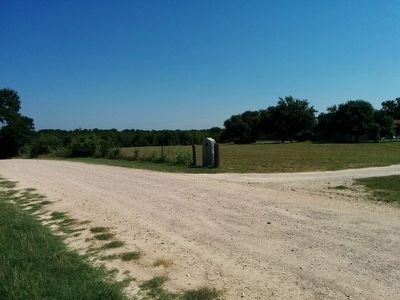
Photographed by Gregory Walker, June 10, 2015
2. Mission Nuestra Señora de la Candelaria Marker location
Looking north towards marker.
Credits. This page was last revised on June 16, 2016. It was originally submitted on June 22, 2015, by Gregory Walker of La Grange, Texas. This page has been viewed 1,083 times since then and 60 times this year. Photos: 1, 2. submitted on June 22, 2015, by Gregory Walker of La Grange, Texas. • Bernard Fisher was the editor who published this page.
