Near Lawrenceburg in Lawrence County, Tennessee — The American South (East South Central)
The Old Natchez Trace
(Marker #1)
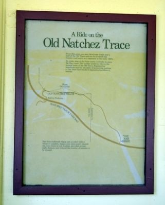
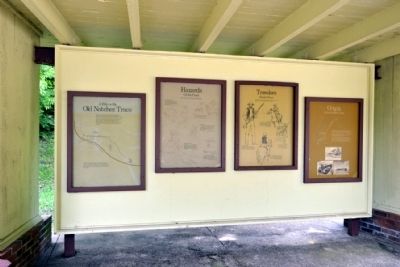
A Ride on the Old Natchez Trace
From this point you may drive over a mile and a half of the Old Trace and see for yourself this frontier road much as it appeared in the early 1800's.
En route, stop at the three scenic overlooks to enjoy the fine views. The modern parkway follows the general route of the Old Trace. Engineering standards and the necessity of preserving sections of the Trace have made it impractical to follow it exactly.
The Trace followed ridges and avoided valleys wherever possible. Ridges were more easily cleared out, were dryer in wet weather, provided greater sight distance and reduced the number of streams to be crossed.
(Marker #2)
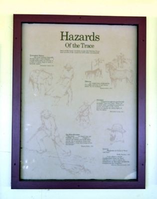
Hazards Of the Trace
Some of the hardy travelers on the Old Natchez Trace kept records of the numerous difficulties encountered.
Torrential Rains
“... the most profuse heavenly shower-bath I every enjoyed ... I would rather take my chance in a field of battle, than in such a tornado again.”
Alexander Lewis, 1811
Thieves
“... our camp (was) surprised in the night, and two of our horses stolen, by the Indians.”
Francis Baily, 1797
Swamps
“... I passed through the most horrid swamps I had ever seen. These are covered with a prodigious growth of canes, and high woods, which ... shut out almost the whole light of day for miles.”
Alexander Lewis, 1811
Swollen Streams
“This creek ... we found was not fordable; we were ... obliged to unload our horses and swim them across. As to ourselves, there was fortunately a large tree lying across the stream.” Francis Baily, 1797
Insects
“... Muskeetos & Gnats & Water very bad.”
Phillip Buckner, 1801
“... I can adjust a simple handkerchief about my head and face in a way to parry the mosquitoes, or their more formidable companions the horseflies.”
Harman Blennerhassett, 1807
(Marker #3)
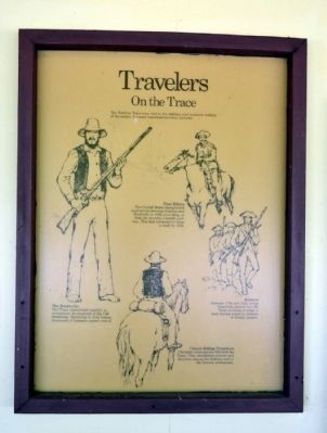
Travelers On the Trace
The Natchez Trace was vital to the military and economic welfare of the nation. Its most important travelers included ...
Post Riders
The United States inaugurated mail service between Natchez and Nashville in 1800, providing, at first, for one trip a month each way. This had increased to three a week by 1816.
The Kaintucks
The Trace contributed mightily to commercial development of the Old Southwest. Returning to their homes, thousands of boatmen passed over it.
Soldiers
Between 1798 and 1815, troops frequently passed over the Trace in times of crisis to meet threats posed by Indians or foreign powers.
Circuit-Riding Preachers
Christian missionaries followed the Trace. They established schools and churches among the Indians and in the frontier settlements.
(Marker #4)
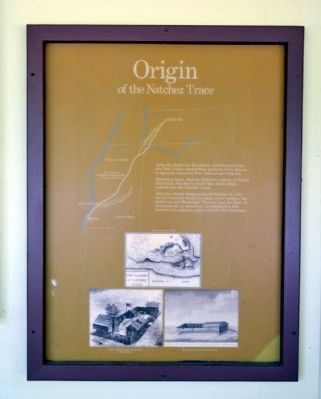
Origin of the Natchez Trace
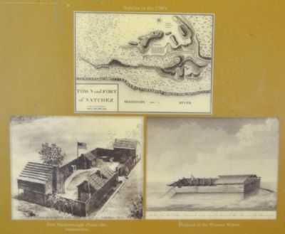
After the American Revolution, frontiersmen from the Ohio Valley carried their products down stream to Spanish controlled New Orleans and Natchez.
Returning home, boatmen followed a series of Indian trails from Natchez to Nashville—trails which evolved into the Natchez Trace.
After the United States acquired Natchez in 1798, the Government decided to clear a road between the newly-created Mississippi Territory and the State of Tennessee as an important communication link between the national capital and the Old Southwest.
Erected by National Park Service.
Topics and series. This historical marker is listed in this topic list: Roads & Vehicles. In addition, it is included in the Natchez Trace series list. A significant historical year for this entry is 1811.
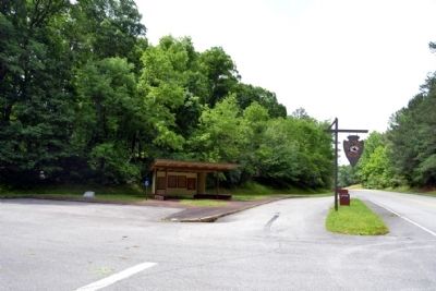
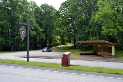
Location. 35° 23.393′ N, 87° 32.06′ W. Marker is near Lawrenceburg, Tennessee, in Lawrence County. Marker can be reached from the intersection of Natchez Trace Parkway (at milepost 375.8) and Laurel Hill Road (Old Trace Drive), on the right when traveling north. Marker is located at the Old Trace Drive turnout. Touch for map. Marker is in this post office area: Lawrenceburg TN 38464, United States of America. Touch for directions.
Other nearby markers. At least 8 other markers are within 9 miles of this marker, measured as the crow flies. This Monument Marks The Old Natchez Trace (a few steps from this marker); Natchez Trace (approx. 5.4 miles away); Steele's Iron Works (approx. 6 miles away); Metal Ford (approx. 6 miles away); Army of Tennessee (approx. 6.9 miles away); Forty Eight Forge (approx. 7.9 miles away); Dogwood Mudhole (approx. 8.1 miles away); Wayne Furnace (approx. 8.9 miles away). Touch for a list and map of all markers in Lawrenceburg.
Also see . . . Natchez Trace. Official National Park Service website. (Submitted on June 23, 2015.)
Credits. This page was last revised on June 16, 2016. It was originally submitted on June 23, 2015, by Duane Hall of Abilene, Texas. This page has been viewed 507 times since then and 28 times this year. Photos: 1, 2, 3, 4, 5, 6, 7, 8. submitted on June 23, 2015, by Duane Hall of Abilene, Texas.
