Jacks Creek in Chester County, Tennessee — The American South (East South Central)
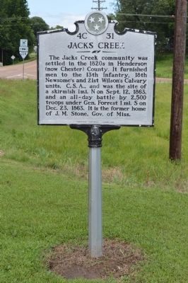
Jacks Creek
Erected by Tennessee Historical Commission. (Marker Number 4C 31.)
Topics and series. This historical marker is listed in these topic lists: Settlements & Settlers • War, US Civil. In addition, it is included in the Tennessee Historical Commission series list. A significant historical month for this entry is September 1919.
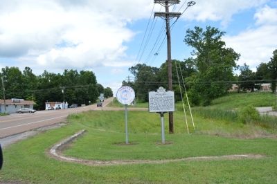
Location. 35° 28.285′ N, 88° 31.293′ W. Marker is in Jacks Creek, Tennessee, in Chester County. Marker is at the intersection of State Highway 100 and State Route 22, on the right when traveling east on State Highway 100. Touch for map. Marker is at or near this postal address: 7185 Hwy 100, Jacks Creek TN 38347, United States of America. Touch for directions.
Other nearby markers. At least 8 other markers are within 8 miles of this marker, measured as the crow flies. Colonel John Purdy (approx. 6.4 miles away); Cox's Raid (approx. 6.9 miles away); Freed-Hardeman College (approx. 7 miles away); Chester County Courthouse (approx. 7 miles away); Fighting For Control (approx. 7 miles away); Tornado of 1952 (approx. 7 miles away); Chester County War Memorial (approx. 7 miles away); Eddy Arnold (approx. 7.1 miles away).
Credits. This page was last revised on June 16, 2016. It was originally submitted on June 28, 2015, by Phillip Knecht of Holly Springs, Mississippi. This page has been viewed 694 times since then and 50 times this year. Photos: 1, 2. submitted on June 28, 2015, by Phillip Knecht of Holly Springs, Mississippi. • Bernard Fisher was the editor who published this page.

