Inglis in Riding Mountain West Municipality, Manitoba — Canada’s Prairie Region (North America)
Inglis Grain Elevators

Photographed by Jimmy Emerson, 2013
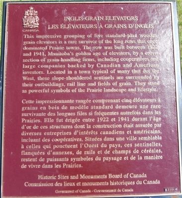
1. Inglis Grain Elevators Marker

Cette impressionnante rangée comprenant cinq élévateurs à grains en bois de modèle standard demeure une rare survivant des longues files so fréquentes autrefois dans les Prairies. Elle fut érigée entre 1922 et 1941 durant l’âge d’or de ces structures dont la construction était asurée par diverses enterprises d’intérêts canadiens et américains, incluant des coopératives. Situées dans une ville semblable à celles qui ponctuent l’Ouest du pays, ces sentinelles, flanquées d’annexes, de rails et de champs de céréales,
this page online
Erected 2000 by Historic Sites and Monuments Board of Canada.
Topics and series. This historical marker is listed in these topic lists: Agriculture • Industry & Commerce. In addition, it is included in the Canada, Historic Sites and Monuments Board series list. A significant historical year for this entry is 1922.
Location. 50° 56.705′ N, 101° 14.934′ W. Marker is in Inglis, Manitoba, in Riding Mountain West Municipality. It is on Railway Avenue, on the left when traveling south. Touch for map. Marker is in this post office area: Inglis MB R0J 0X0, Canada. Touch for directions.

Regionally, this marker is in the Parkland Region. It is also in the Prairies. Globally, it is in North America, the Western Hemisphere, the Western World, and the Anglosphere. Historically, it finds itself in what was once a British colony, the Viceroyalty of New France, and Rupert’s Land.
Other nearby markers. At least 4 other markers are within 19 kilometers of this marker, measured as the crow flies: A different marker also named Inglis Grain Elevators
Photographed by Dawn Bowen, June 21, 2008
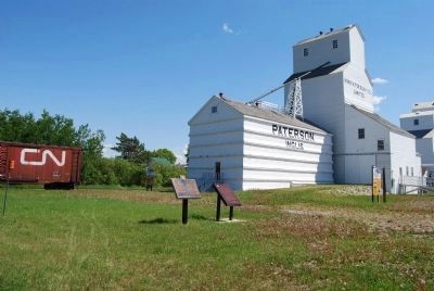
2. Inglis Grain Elevators Marker
Also see . . . Five Prairie Giants: Inglis Grain Elevators National Historic Site. (Submitted on June 23, 2008, by Dawn Bowen of Fredericksburg, Virginia.)
Photographed by Dawn Bowen, June 21, 2008
3. Inglis Grain Elevators Marker
Photographed by Dawn Bowen, June 21, 2008
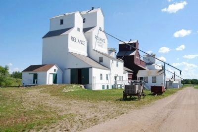
4. Row of Grain Elevators
Photographed by Dawn Bowen, June 21, 2008
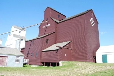
5. Northern Elevator
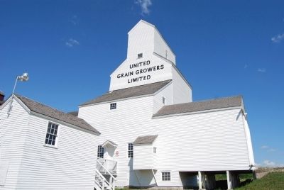
Photographed by Dawn Bowen, June 21, 2008
6. United Grain Growers Elevators
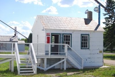
Photographed by Dawn Bowen, June 21, 2008
7. Grain Elevators Office
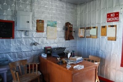
Photographed by Dawn Bowen, June 21, 2008
8. Interior of Elevators Office
Credits. This page was last revised on December 21, 2025. It was originally submitted on June 22, 2008, by Dawn Bowen of Fredericksburg, Virginia. This page has been viewed 3,073 times since then and 10 times this year. Photos: 1. submitted on November 20, 2025, by Jimmy Emerson of Dalton, Georgia. 2, 3, 4, 5, 6, 7, 8. submitted on June 22, 2008, by Dawn Bowen of Fredericksburg, Virginia. • Kevin W. was the editor who published this page.
