Gifford Pinchot National Forest in Skamania County, Washington — The American West (Northwest)
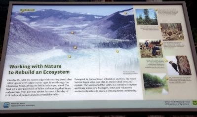
Working with Nature to Rebuild an Ecosystem
— Mount St. Helens National Volcanic Monument —
Inscription.
On May 18, 1980, the eastern edge of the searing lateral blast
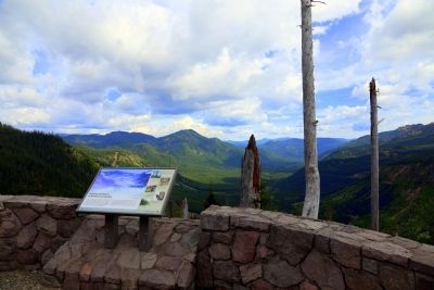
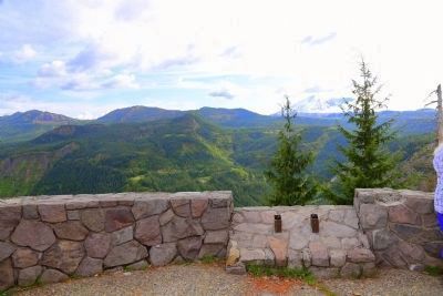
rolled up and over ridges to your right. It tore through the Clearwater Valley, lifting just behind where you stand. The blast left a gray patchwork of fallen and standing dead trees,
and clearings from previous timber harvests. A blanket of 6-14 inches of pumice and ash covered the valley.
Prompted by fears of insect infestation and fires, the Forest Service began a five year plan to remove dead trees and replant. They envisioned this valley as a complex ecosystem and living laboratory. Managers, crews and volunteers worked with nature to create a thriving forest community.
(captions for five photographs on the sidebar)
1. Noble and Pacific silver fir were planted at high elevations when they naturally occur. Contractors now carefully harvest fir boughs for holiday greenery. This fir’s low branches were harvested the year before. Proceeds fund watershed restoration.
2. Crews replanted trees among downed wood and standing snags. Fallen trees decompose, helping to build soil.
3. Crews and volunteer groups planted native Douglas and grand fir, and western redcedar on the valley floor. They mixed in 4% cottonwood and lodgepole pine to add diversity.
4. During timber salvage, the Forest Service left ¼ acre to 5 acre plots untouched for wildlife habit and soil enrichment. Standing dead trees provide insects and shelter for woodpeckers and other cavity nesters.
5. Next to Clearwater Creek, crews planted black cottonwood, willow and alder to stabilize banks, provide cooling shade for fish, and food for deer and elk.
Erected by Gifford Pinchot National Forest, US Department of Agriculture.
Topics. This historical marker is listed in these topic lists: Disasters • Environment. A significant historical month for this entry is May 1880.
Location. 46° 17.94′ N, 122° 3.018′ W. Marker is in Gifford Pinchot National Forest, Washington, in Skamania County. Marker is on Forest Road NF-99, 6.6 miles Forest Road NF-25, on the left. Touch for map. Marker is in this post office area: Randle WA 98377, United States of America. Touch for directions.
Other nearby markers. At least 6 other markers are within 6 miles of this marker, measured as the crow flies. The Earth’s Monumental Power (here, next to this marker); More Than He Bargained For (approx. 1.2 miles away); Survivors Create Spectacular Change (approx. 3.1 miles away); Hearts of Volcanoes Beat Beneath Peaceful Facades (approx. 4.6 miles away); Mount St. Helens (approx. 4.6 miles away); The Pumice Plain (approx. 5.4 miles away).
More about this marker. A number of scenic pull-offs with paved parking lots, some with toilet facilities, are found on Forest Road 99 en route to Windy Ridge. This is at the second pull-off. The National Park access fee is applicable.
Directions from Randle: From U.S. 12 in Randle WA, take WA-131 south for 2.8 miles. It becomes Forest Road 25. Continue on Forest Road 25 for another 24.3 miles to the junction with Forest Road 99. Turn right onto Forest Road 99 towards Windy Ridge.This marker will on your left approximately 6.6 miles up Forest Road 99.
Directions from Cougar: Take Lewis River Road east for 2.8 miles. The road then changes to Forest Road 90. Continue on Forest Road 90 for 16 miles and stay to the left on Forest Road 25, pass the Pine Creek Information Center. Drive Forest Road 25 for 25 miles and turn left at the junction with Forest Road 99. This marker will be on your left approximately 6.6 miles up Forest Road 99.
Credits. This page was last revised on June 16, 2016. It was originally submitted on July 2, 2015, by J. J. Prats of Powell, Ohio. This page has been viewed 345 times since then and 14 times this year. Photos: 1, 2, 3. submitted on July 2, 2015, by J. J. Prats of Powell, Ohio.


