Gifford Pinchot National Forest in Skamania County, Washington — The American West (Northwest)
The Earth’s Monumental Power
— Mount St. Helens National Volcanic Monument —
Inscription.
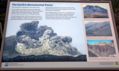
This landscape is a monument to the Earth’s power.
The incredible story began on March 20, 1980, when magma began rising into Mount St. Helens. The volcano’s summit diverted the magma sideways, shoving the northern slope outward at a rate of five feet per day.
On the morning of May 18th, the north face of Mount St. Helens collapsed in a gigantic landslide. Super-heated groundwater flashed to steam and gases dissolved in the magma burst outward in a hurricane-force blast of hot gas, ash and rock. The ground-hugging lateral blast killed trees as far as 17 miles away.
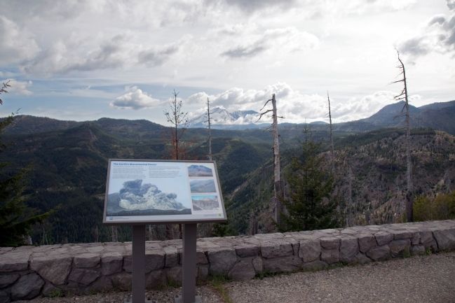
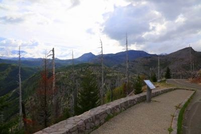
The standing dead trees around you were killed by that blast. A portion of the landscape transformed by this exceptional event was set aside as Mount St. Helens National Volcanic Monument. The Monument serves as a reminder of the awesome power of volcanoes.
(photo captions)
Tree Removal Zone: 0 to 7.5 miles from the mountain. The lateral blast uprooted, shattered and swept away the forest.
Blowdown Zone: 7.5 to 15.5 miles from the mountain. The blast blew down try., Topography channeled the blast cloud, leaving some trees standing.
Ion stand in the Scorch Zone: 2 to 17 miles front the mountain. The heat of the blast scorched and killed trees, creating a ghostly, standing dead forest.
Erected by Gifford Pinchot National Forest, US Department of Agriculture.
Topics. This historical marker is listed in these topic lists: Disasters • Environment. A significant historical month for this entry is March 1491.
Location. 46° 17.94′ N, 122° 3.021′ W. Marker is in Gifford Pinchot National Forest, Washington, in Skamania County. Marker is on Forest Road NF-99, 6.6 miles Route NF-25. Touch for map. Marker is in this post office area: Randle WA 98377, United States of America. Touch for directions.
Other nearby markers. At least 6 other markers are within 6 miles of this marker, measured as the crow flies. Working with Nature to Rebuild an Ecosystem (here, next to this marker); More Than He Bargained For (approx. 1.2 miles away); Survivors Create Spectacular Change (approx. 3.1 miles away); Hearts of Volcanoes Beat Beneath Peaceful Facades (approx. 4.6 miles away); Mount St. Helens (approx. 4.6 miles away); The Pumice Plain (approx. 5.4 miles away).
More about this marker. A number of scenic pull-offs with paved parking lots, some with toilet facilities, are found on Forest Road 99 en route to Windy Ridge. This is at the second pull-off. The National Park access fee is applicable.
Directions from Randle: From U.S. 12 in Randle WA, take WA-131 south for 2.8 miles. It becomes Forest Road 25. Continue on Forest Road
25 for another 24.3 miles to the junction with Forest Road 99. Turn right onto Forest Road 99 towards Windy Ridge.This marker will on your left approximately 6.6 miles up Forest Road 99.
Directions from Cougar: Take Lewis River Road east for 2.8 miles. The road then changes to Forest Road 90. Continue on Forest Road 90 for 16 miles and stay to the left on Forest Road 25, pass the Pine Creek Information Center. Drive Forest Road 25 for 25 miles and turn left at the junction with Forest Road 99. This marker will be on your left approximately 6.6 miles up Forest Road 99.
Credits. This page was last revised on June 16, 2016. It was originally submitted on July 3, 2015, by J. J. Prats of Powell, Ohio. This page has been viewed 411 times since then and 12 times this year. Photos: 1, 2, 3. submitted on July 3, 2015, by J. J. Prats of Powell, Ohio.


