First Ward in Buffalo in Erie County, New York — The American Northeast (Mid-Atlantic)
The South Pier
Photographed by Anton Schwarzmueller, June 3, 2015
1. The South Pier Marker
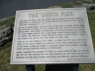
In 1820 villagers built a 900-foot pier at this site by placing wooden cribs on thick beds of brush and then filling them with heavy stone. Early next spring, using a pile driver fashioned from a war of 1812 mortor and powered by a blind horse, workers built a dam across nearby Buffalo Creek in hopes of turning the expected spring floods to scour a new, straight channel across the gravel spit and along the new pier.
Just as all was ready, a lake surge flooded the spit and destroyed much of the dam. A storm followed, its heavy rains signaling the start of the spring floods, and scores of villagers turned out to work 12 hours straight before finishing repairs by torchlight.
Spring freshets that morning scoured out 20,000 yards of sand and gravel and out the new channel. The pier was extended to 1,320 feet that summer, offering shelter from storms and a port for Buffalo's growing commerce.
Erected by Buffalo Lighthouse Association.
Topics and series.
this page online
Location. 42° 52.654′ N, 78° 53.127′ W. Marker is in Buffalo, New York, in Erie County. It is in the First Ward. It can be reached from Fuhrmann Boulevard 1.3 miles north of The Skyway (New York State Route 5). Marker is on the gated walkway by the Coast Guard station. The walkway is accessed at the northern terminus of Fuhrmann Boulevard. The walkway is open 10A to sunset. Touch for map. Marker is at or near this postal address: 1 Fuhrman Boulevard, Buffalo NY 14203, United States of America. Touch for directions.

Regionally, this marker is in Upstate New York and specifically in Western New York. It is also in the American Northeast and in the Mid-Atlantic. Globally, it is in North America, on the Great Lakes, in the Western Hemisphere, in the Western World, and in the Anglosphere. Historically, it finds itself in what was once the Viceroyalty of New France, the Haudenosaunee (Iroquois) Confederacy, New Netherland, and one of the original Thirteen
Photographed by Anton Schwarzmueller, June 3, 2015
2. Towards Walkway Gate
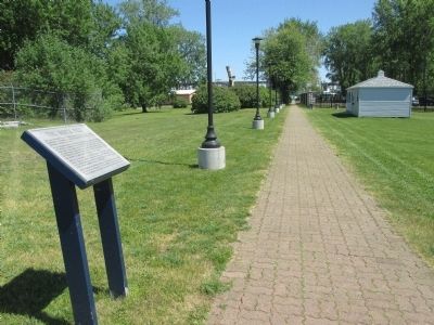
Marker at left. You first approach the marker from the gate at the north end of Fuhrmann Boulevard in the background. The small information building at right has no public facilities.
Other nearby markers. At least 8 other markers are within walking distance of this marker: The Lighthouse Service (within shouting distance of this marker); The Coast Guard (within shouting distance of this marker); The Lifeboat Station (about 300 feet away, measured in a direct line); Lighthouse Point Park (about 400 feet away); Penobscot-Morania Collision (about 600 feet away); International Shipmasters' Association (about 700 feet away); The Industrial Heritage Trail (approx. 0.2 miles away); Western New York Vietnam Veterans Monument (approx. 0.2 miles away). Touch for a list and map of all markers in Buffalo.
Another marker is no longer nearby. Birthplace of the Grain Elevator (was about 800 feet away but has been confirmed missing).
Photographed by Anton Schwarzmueller, June 3, 2015
3. Approaching The South Pier Marker
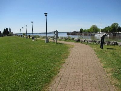
Note that the marker is at the angle on the walkway. The Buffalo Lighthouse is at the left in the distance. This is the Buffalo River flowing into Lake Erie.
Photographed by Anton Schwarzmueller, June 3, 2015
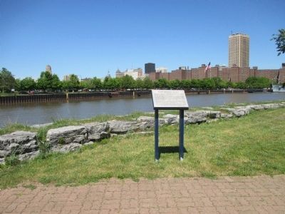
4. The South Pier Marker
Credits. This page was last revised on February 16, 2023. It was originally submitted on July 3, 2015, by Anton Schwarzmueller of Wilson, New York. This page has been viewed 671 times since then and 29 times this year. Photos: 1, 2, 3, 4. submitted on July 3, 2015, by Anton Schwarzmueller of Wilson, New York.
