First Ward in Buffalo in Erie County, New York — The American Northeast (Mid-Atlantic)
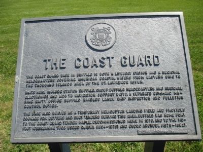
The Coast Guard
Photographed by Anton Schwarzmueller, June 3, 2015
1. The Coast Guard Marker
Units here include station Buffalo, Group Buffalo Headquarters and Regional Electronics and Aids to Navigation support units. A separate marine safety office Buffalo handles large ship inspection and pollution control duties.
The base also serves as a temporary heliocopter landing field and provides dockage for cutters and body tenders serving theis area. Buffalo was home port to the Couast Guard tender Maple, decommissioned here in 1973, and to the 110-foot icebreaking tugs USCGC Ojibwa (1954-1979) and USCGS Arundel (1979-1982).
Erected by Buffalo Lighthouse Association.
Topics and series. This historical marker is listed in these topic lists: Charity & Public Work • Waterways & Vessels. In addition, it is included in the Lighthouses series list.
Location. 42° 52.657′ N, 78° 53.168′ W. Marker is in Buffalo, New York, in Erie County. It is in the First Ward. It can be
this page online

Regionally, this marker is in Upstate New York and specifically in Western New York. It is also in the American Northeast and in the Mid-Atlantic. Globally, it is in North America, on the Great Lakes, in the Western Hemisphere, in the Western World, and in the Anglosphere. Historically, it finds itself in what was once the Viceroyalty of New France, the Haudenosaunee (Iroquois) Confederacy, New Netherland, and one of the original Thirteen Colonies.
Other nearby markers. At least 8 other markers are within walking distance of this marker: The Lighthouse Service (within shouting distance of this marker); The Lifeboat Station (within shouting distance of this marker); The South Pier (within shouting distance of this marker); Penobscot-Morania Collision (about 500 feet away, measured in a direct line); International Shipmasters' Association
Photographed by Anton Schwarzmueller, June 3, 2015
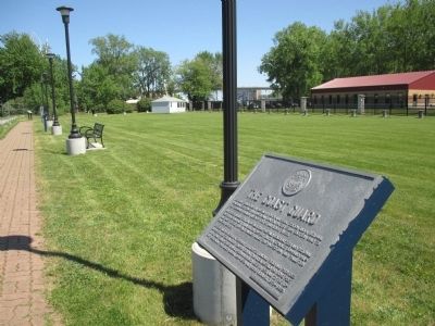
2. Towards Walkway Access
The gated walkway comes this way from the north end of Fuhrmann Boulevard. The Coast Guard Base is fenced at right.
Photographed by Anton Schwarzmueller, June 3, 2015
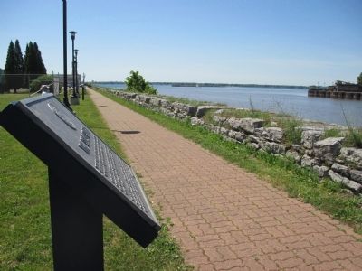
3. Towards Lake Erie
Buffalo Lighthouse in-line with lampposts. Buffalo River at right.
Credits. This page was last revised on February 16, 2023. It was originally submitted on July 4, 2015, by Anton Schwarzmueller of Wilson, New York. This page has been viewed 564 times since then and 28 times this year. Photos: 1, 2, 3. submitted on July 4, 2015, by Anton Schwarzmueller of Wilson, New York.
