Coliseum
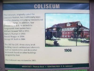
1906
— Architect: Thomas Bast • Contractor: T. H. Johnson —
The Coliseum, originally called the Livestock Pavilion, has traditionally been used for showing and judging livestock and for horse shows. In addition, four presidents who have visited the Fairgrounds have spoken here –
Harry S. Truman in 1955
Ronald Reagan in 1984
George W. Bush in 2004
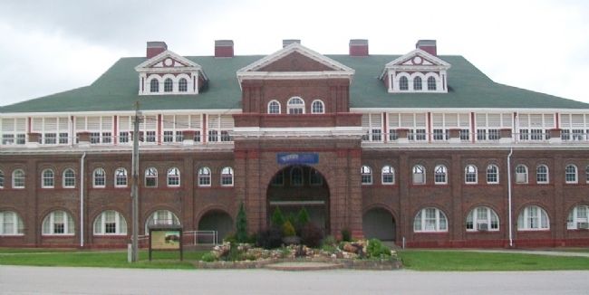
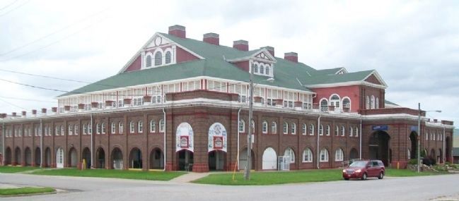
The 180' by 235', three-story, brick building repeats architectural elements such as round arches and decorative brickwork found on other buildings designed by Bast.
The Coliseum was restored in 2001.
Erected by Missouri State Fair Commission.
Topics and series. This historical marker is listed in these topic lists: Agriculture • Animals • Architecture. In addition, it is included in the Former U.S. Presidents: #27 William Howard Taft, the Former U.S. Presidents: #33 Harry S. Truman, the Former U.S. Presidents: #40 Ronald Reagan, and the Former U.S. Presidents: #43 George W. Bush series lists. A significant historical year for this entry is 1911.
Location. 38° 41.716′ N, 93° 15.462′ W. Marker is in Sedalia, Missouri, in Pettis County. Marker and building are on the Missouri State Fairgrounds. Touch for map. Marker is at or near this postal address: 2503 West 16th Street, Sedalia MO 65301, United States of America. Touch for directions.
Other nearby markers.
Also see . . .
1. Missouri State Fairgrounds Historic District. National Register of Historic Places Registration Form (Submitted on July 5, 2015, by William Fischer, Jr. of Scranton, Pennsylvania.)
2. Missouri State Fair History. Fair website entry (Submitted on June 3, 2022, by Larry Gertner of New York, New York.)
Credits. This page was last revised on June 3, 2022. It was originally submitted on July 5, 2015, by William Fischer, Jr. of Scranton, Pennsylvania. This page has been viewed 363 times since then and 18 times this year. Photos: 1, 2, 3. submitted on July 5, 2015, by William Fischer, Jr. of Scranton, Pennsylvania.


