Lanesborough in Berkshire County, Massachusetts — The American Northeast (New England)
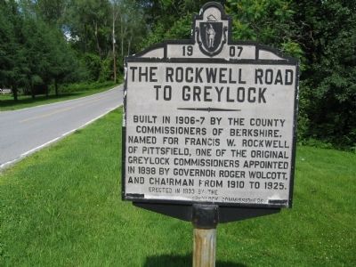
The Rockwell Road To Greylock
The Rockwell Road
To Greylock
Erected in 1933 by the Greylock Commissioners
Topics. This historical marker is listed in this topic list: Roads & Vehicles. A significant historical year for this entry is 1907.
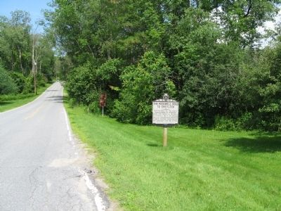
Location. 42° 32.872′ N, 73° 13.108′ W. Marker is in Lanesborough, Massachusetts, in Berkshire County. Marker is at the intersection of Rockwell Road and Quarry Road, on the right when traveling north on Rockwell Road. Touch for map. Marker is in this post office area: Lanesboro MA 01237, United States of America. Touch for directions.
Other nearby markers. At least 8 other markers are within 4 miles of this marker, measured as the crow flies. Welcome to Mount Greylock State Reservation (approx. half a mile away); Lanesborough Remembers (approx. 2 miles away); In Memory of Jonathan Smith (approx. 2 miles away); The First and Second Meeting Houses of Lanesborough (approx. 2.1 miles away); Daniel H. Petithory (approx. 2˝ miles away); Ashuwillticook Rail Trail (approx. 2˝ miles away); Berkshire County Patriots (approx. 3 miles away); Cheshire’s Mammoth Cheese (approx. 3.3 miles away). Touch for a list and map of all markers in Lanesborough.
Regarding The Rockwell Road To Greylock. The Rockwell Road takes you to the summit of Mount Greylock, tallest peak in Massachusetts.
Credits. This page was last revised on June 16, 2016. It was originally submitted on July 5, 2015, by Michael Herrick of Southbury, Connecticut. This page has been viewed 324 times since then and 16 times this year. Photos: 1, 2. submitted on July 5, 2015, by Michael Herrick of Southbury, Connecticut.

