Sedalia in Pettis County, Missouri — The American Midwest (Upper Plains)
Missouri State Highway System
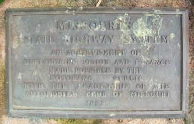
Photographed by William Fischer, Jr., June 21, 2015
1. Missouri State Highway System Marker
Automobile Club of Missouri
Erected 1932.
Topics. This historical marker is listed in this topic list: Roads & Vehicles.
Location. 38° 41.452′ N, 93° 15.561′ W. Marker is in Sedalia, Missouri, in Pettis County. It can be reached from West 16th Street. Marker is at the MoDOT Highway Gardens, on the Missouri State Fairgrounds. Touch for map. Marker is at or near this postal address: 2503 West 16th Street, Sedalia MO 65301, United States of America. Touch for directions.

Regionally, this marker is in the Missouri River Corridor. It is also in the American Midwest, in the Lewis & Clark Corridor, in the Corn Belt, and on the Santa Fe Trail Corridor. Globally, it is in North America, the Western Hemisphere, the Western World, and the Anglosphere. Historically, it finds itself in what was once the territory of the Mississippian Culture, the Louisiana Purchase, and the Antebellum South.
Other nearby markers. At least 8 other markers are within
this page online
Also see . . .
1. Missouri State Highway System. Wikipedia entry (Submitted on June 5, 2022, by Larry Gertner of New York, New York.)
2. Interstate highway system began in Missouri 65 years ago this month. Metro Voice website entry, 2021 (Submitted on June 5, 2022, by Larry Gertner of New York, New York.)
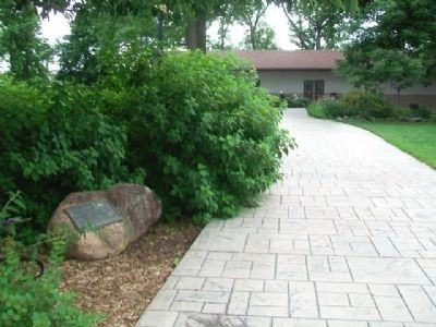
Photographed by William Fischer, Jr., June 21, 2015
2. Missouri State Highway System Marker
Credits. This page was last revised on June 5, 2022. It was originally submitted on July 5, 2015, by William Fischer, Jr. of Reynoldsburg, Ohio. This page has been viewed 496 times since then and 27 times this year. Photos: 1, 2. submitted on July 5, 2015, by William Fischer, Jr. of Reynoldsburg, Ohio.
