Lanesborough in Berkshire County, Massachusetts — The American Northeast (New England)
Mount Greylock, Elevation 3,491 Feet
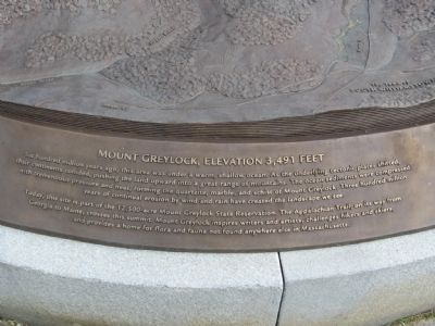
Mount Greylock, Elevation 3,491 Feet
Six hundred million years ago, this area was under a warm shallow ocean. As the underlying tectonic plates shifted, their continents collided, pushing the land upward into a great range of mountains. The ocean sediments were compressed with tremendous pressure and heat, forming the quartzite, marble, and schist of Mount Greylock. Three hundred million years of continual erosion by wind and rain have created the landscape we see.
Today, this site is part of the 12,500-acre Mount Greylock State Reservation. The Appalachian Trail, on its way from Georgia to Maine, crosses this summit. Mount Greylock inspires writers and artists, challenges hikers and skiers, and provided a home for flora and fauna not found anywhere else in Massachusetts.
Topics. This historical marker is listed in this topic list: Environment.
Location. 42° 38.236′ N, 73° 10.007′ W. Marker is in Lanesborough, Massachusetts, in Berkshire County. Marker can be reached from Rockwell Road, 8.6 miles Quarry Road when traveling north. Located at the summit of Mount Greylock, tallest peak in Massachusetts. Touch for map. Marker is at or near this postal address: 30 Rockwell Road, Lanesboro MA 01237, United States of America. Touch for directions.
Other nearby markers. At least 8 other markers are within walking distance of this marker. The Summit: An Island Above the Clouds (here, next to this marker); The Mount Greylock Summit (here, next to this marker); Mount Greylock, elevation 3,491 feet (within shouting distance of this marker); "A Beacon Standing for Peace" (within shouting distance of this marker); The Summit: A Peak Experience (within shouting distance of this marker); Bascom Lodge (within shouting distance of this marker); Veterans War Memorial Tower (within shouting distance of this marker); War Memorial Tower (within shouting distance of this marker). Touch for a list and map of all markers in Lanesborough.
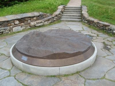
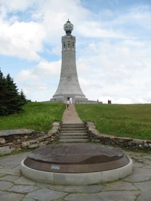
More about this marker. The marker is a bronze relief sculpture of Mount Greylock and the surrounding area, showing mountains, lakes, towns and trails. The sculpture is on the Appalachian Trail which runs over the top of the mountain.
Also see . . .
1. Mount Greylock State Reservation. (Submitted on July 5, 2015, by Michael Herrick of Southbury, Connecticut.)
2. Mount Greylock on Wikipedia. (Submitted on July 5, 2015, by Michael Herrick of Southbury, Connecticut.)
Credits. This page was last revised on June 16, 2016. It was originally submitted on July 5, 2015, by Michael Herrick of Southbury, Connecticut. This page has been viewed 374 times since then and 13 times this year. Photos: 1, 2, 3. submitted on July 5, 2015, by Michael Herrick of Southbury, Connecticut.


