Franklin in St. Mary Parish, Louisiana — The American South (West South Central)
Franklin's Historic Lampposts
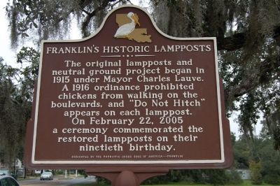
Photographed by Cajun Scrambler, November 21, 2009
1. Franklin's Historic Lampposts Marker
Erected by Patriotic Order Sons of America - - Franklin.
Topics. This historical marker is listed in these topic lists: Animals • Roads & Vehicles. A significant historical month for this entry is February 1542.
Location. 29° 47.099′ N, 91° 29.849′ W. Marker is in Franklin, Louisiana, in St. Mary Parish. It is on Main Street (State Highway 182) north of Foster Avenue, on the right when traveling north. Touch for map. Marker is in this post office area: Franklin LA 70538, United States of America. Touch for directions.

Regionally, this marker is in one of Louisiana’s River Parishes, in Acadiana — Cajun Country, and specifically in Bayou Country. It is also in the American South, specifically in the Deep South, on the Gulf Coast, and in the Great River Road Region. Globally, it is in North America, a Gulf of Mexico
this page online
Other nearby markers. At least 8 other markers are within walking distance of this marker: St. Mary Parish Courthouse War Memorial (approx. 0.4 miles away); St. Mary Parish Confederate Soldiers Monument (approx. half a mile away); The Gunboat Diana (approx. half a mile away); Battle Of Irish Bend (approx. half a mile away); Franklin (approx. half a mile away); Jared Young Sanders (approx. half a mile away); Charles Austin O'Niell (approx. half a mile away); Edward V. Loustalot (approx. half a mile away). Touch for a list and map of all markers in Franklin.
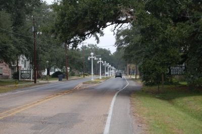
Photographed by Cajun Scrambler, November 21, 2009
2. Franklin's Historic Lampposts
Credits. This page was last revised on October 5, 2025. It was originally submitted on July 5, 2015. This page has been viewed 757 times since then and 52 times this year. Photos: 1, 2. submitted on July 5, 2015. • Bernard Fisher was the editor who published this page.
