Raymond in Hinds County, Mississippi — The American South (East South Central)
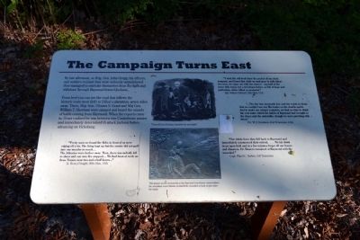
The Campaign Turns East
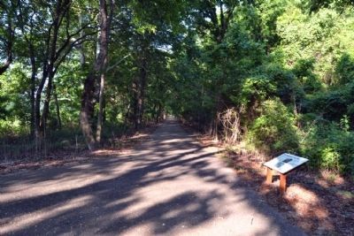
From here you can see the road that follows the historic route west (left) to Dillon’s plantation, seven miles away. There, Maj. Gen. Ulysses S. Grant and Maj. Gen. William T. Sherman were camped and heard the sounds of battle coming from Raymond. When the reports came in, Grant realized he was between two Confederate armies and immediately determined to attack Jackson before advancing on Vicksburg.
“Pretty soon we found the Rebs in front of us were edging off a bit. The firing kep up but the smoke did not puff into our mouths so much ....
The Johnnies were farther away. Then, there was nobody left to shoot and our fire stopped .... We had been at work on those Texans near two and half hours ....”
Lt. Henry Dwight, 20th Ohio, USA
“I took the roll-book from the pocket of our dead sergeant, and found that while we had gone in with thirty-two men, we came out with but sixteen – one-half of the brave little band, but a few hours before so full of hope and patriotism, either killed or wounded.”
Sgt. Osborn Oldroyd, 20th Ohio, USA
“... The day was unusually hot, and the roads so dusty that we couldn’t see our file leader on the double-quick. And to make our misery complete, we had no time to drink the cool water which the ladies of Raymond had brought to the doors and the sidewalks, though we were parching with thirst.”
Pvt. W.J. Davidson, 41st Tennessee, CSA
“Our whole force then fell back to Raymond and immediately commenced their retreat. ... We lay down in an open field and in a few minutes forgot all our losses and disasters. Dr. Bowers remained at Raymond with the wounded.”
Capt. Flavel C. Barber, 3rd Tennessee
(Lower Photo Caption)
This plaque on the monument at the Raymond courthouse memorializes the assistance local citizens provided the wounded of both armies after the battle.
Topics. This historical marker is listed in this topic list: War, US Civil.
Location. 32° 14.691′ N, 90° 26.635′ W. Marker is in Raymond, Mississippi, in Hinds County. Marker can be reached from Port Gibson Street, 0.1 miles north of Mississippi Highway 18, on the left when traveling north. Marker is located in the main part of the Raymond Military Park; the above directions are to the parking area for the park. Touch for map. Marker is in this post office area: Raymond MS 39154, United States of America. Touch for directions.
Other nearby markers. At least 8 other markers
are within walking distance of this marker. C.S. Gregg's Task Force (a few steps from this marker); Battle of Raymond - This Walking Trail (within shouting distance of this marker); The Battle of Raymond as a Pivotal Point in the Vicksburg Campaign (within shouting distance of this marker); The Little J Railroad (within shouting distance of this marker); The Vicksburg Campaign (within shouting distance of this marker); Confederate Commanders (about 400 feet away, measured in a direct line); Confederate Route to Raymond (about 400 feet away); Gregg's Battle Plan (about 400 feet away). Touch for a list and map of all markers in Raymond.
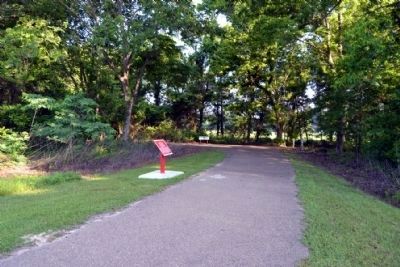
More about this marker. Marker is located along the Raymond Military Park walking trail northwest of the exhibit kiosk. It is a 450-foot walk from the parking area to the marker.
Also see . . . Friends of Raymond. Official website of the Friends of Raymond with detailed information on the Battle of Raymond and the preservation of the battlefield. (Submitted on July 6, 2015.)
Credits. This page was last revised on June 16, 2016. It was originally submitted on July 6, 2015, by Duane Hall of Abilene, Texas. This page has been viewed 357 times since then and 16 times this year. Photos: 1, 2, 3. submitted on July 6, 2015, by Duane Hall of Abilene, Texas.


