Lanesborough in Berkshire County, Massachusetts — The American Northeast (New England)
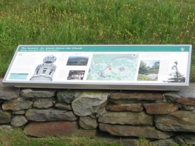
The Summit: An Island Above the Clouds
Mount Greylock State Reservation
The Summit: An Island Above the Clouds
Mount Greylock State Reservation
Welcome to the peak of Mount Greylock, the highest point in Massachusetts and the focal point of the state’s first wilderness park.
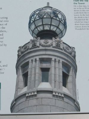
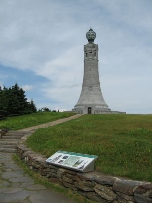
Greylock summit is an unusual and fascinating natural environment shaped by humankind into what is both a recreational park and a place of remembrance. Rising above the summit is the stat’e official monument to her fallen soldiers, the 1932 War Memorial Tower. Surrounded by Massachusetts’only subalpine forest and dramatic outcrops of schist stone, the tower stands at the center of a landscape designed by the Civilian Conservation Corps (CCC) in the 1930s.
Stepping onto Greylock Summit is like landing on a unique island where traces of ancient mountain-building, Ice Age forests, and historic cultural resources survive. Discover clues to our past while enjoying the splwendor of Greylock.
From the Top of the Tower
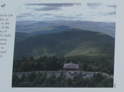
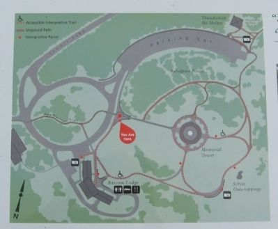
On a clear day, visitors can see as far as 90 miles, as shown in this view to the north from the top of the tower. At the bottom of the photo is the CCC-built Thunderbolt Ski Shelter, which has long warmed skiers brave enough to venture down the famed Thunderbolt Ski Trail.
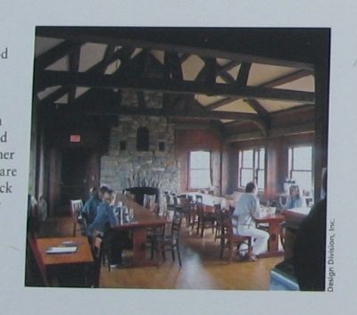
“Parkitecture”
Bascom Lodge offers food and accommodations in a rustic, post-and-beam building, mostly built by the Civilian Conservation Corps from stone quarried on-site. The lodge and other structures on the summit are part of the Mount Greylock Summit National Register Historic District.
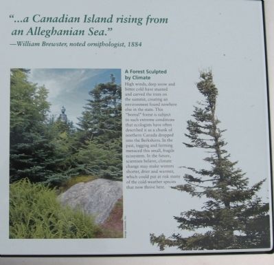
“. . . a Canadian Island rising from an Alleghanian Sea .” – William Brewster, noted ornithologist, 1884
A Forest Sculpted by Climate
High winds, deep snow and bitter cold have stunted and carved the trees on the summit, creating an environment found nowhere else in the state. This “boreal” forest is subject to such extreme conditions that ecologists have often described it as a chunk of northern Canada dropped into the Berkshires. In the past, logging and farming menaced this small, fragile ecosystem. In the future, scientists believe, climate change may make winters shorter, drier and warmer, which could put at risk many of the cold-weather species that now thrive here.
Erected by Massachusetts Department of Conservation and Recreation.
Topics. This historical marker is listed in this topic list: Environment. A significant historical year for this entry is 1932.
Location. 42° 38.233′ N, 73° 10.007′ W. Marker is in Lanesborough, Massachusetts, in Berkshire County. Marker can be reached from Rockwell Road
, 8.6 miles Quarry Road when traveling north. Located at the summit of Mount Greylock, tallest peak in Massachusetts. Touch for map. Marker is at or near this postal address: 30 Rockwell Road, Lanesboro MA 01237, United States of America. Touch for directions.
Other nearby markers. At least 8 other markers are within walking distance of this marker. Mount Greylock, Elevation 3,491 Feet (here, next to this marker); The Mount Greylock Summit (a few steps from this marker); Mount Greylock, elevation 3,491 feet (within shouting distance of this marker); "A Beacon Standing for Peace" (within shouting distance of this marker); The Summit: A Peak Experience (within shouting distance of this marker); Bascom Lodge (within shouting distance of this marker); Veterans War Memorial Tower (within shouting distance of this marker); War Memorial Tower (within shouting distance of this marker). Touch for a list and map of all markers in Lanesborough.
Also see . . .
1. Mount Greylock State Reservation. (Submitted on July 6, 2015, by Michael Herrick of Southbury, Connecticut.)
2. Mount Greylock on Wikipedia. (Submitted on July 6, 2015, by Michael Herrick of Southbury, Connecticut.)
Credits. This page was last revised on June 16, 2016. It was originally submitted on July 6, 2015, by Michael Herrick of Southbury, Connecticut. This page has been viewed 422 times since then and 9 times this year. Photos: 1, 2, 3, 4, 5, 6, 7. submitted on July 6, 2015, by Michael Herrick of Southbury, Connecticut.
