Labadieville in Assumption Parish, Louisiana — The American South (West South Central)
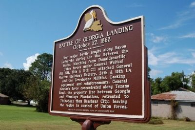
Battle Of Georgia Landing
October 27, 1862
Erected by Louisiana Society Order of Confederate Rose.
Topics. This historical marker is listed in this topic list: War, US Civil.
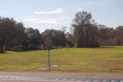
Location. 29° 51.548′ N, 90° 58.858′ W. Marker is in Labadieville, Louisiana, in Assumption Parish. Marker is at the intersection of State Highway 1 and State Highway 1011, on the right when traveling south on State Highway 1. Touch for map. Marker is in this post office area: Napoleonville LA 70390, United States of America. Touch for directions.
Other nearby markers. At least 8 other markers are within 7 miles of this marker, measured as the crow flies. Naquin Settlement (approx. 4.2 miles away); Madewood Plantation House (approx. 4.7 miles away); Edward D. White House (approx. 4.8 miles away); Napoleonville (approx. 6.3 miles away); Assumption Parish WWII Memorial (approx. 6.3 miles away); Great War Memorial (approx. 6.3 miles away); Assumption Parish World War II Memorial (approx. 6.3 miles away); Christ Episcopal Church (approx. 6.4 miles away).
Credits. This page was last revised on September 3, 2022. It was originally submitted on July 10, 2015. This page has been viewed 984 times since then and 67 times this year. Photos: 1. submitted on July 10, 2015. 2. submitted on January 9, 2016. • Bernard Fisher was the editor who published this page.

