Portsmouth in Rockingham County, New Hampshire — The American Northeast (New England)
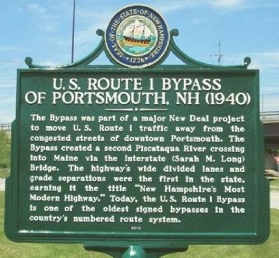
US Route 1 Bypass of Portsmouth, NH (1940)
The Bypass was part of a major New Deal project to move U.S. Route 1 traffic away from the congested streets of downtown Portsmouth. The Bypass created a second Piscataqua River crossing into Maine via the Interstate (Sarah M. Long) Bridge. The highway’s wide divided lanes and grade separations were the first in the state, earning it the title "New Hampshire’s Most Modern Highway." Today, the U.S. Route 1 Bypass is one of the oldest signed bypasses in the country’s numbered route system.
Erected 2013 by New Hampshire Division of Historical Resources. (Marker Number 234.)
Topics and series. This historical marker is listed in these topic lists: Bridges & Viaducts • Roads & Vehicles • Waterways & Vessels. In addition, it is included in the New Hampshire Historical Highway Markers series list. A significant historical year for this entry is 1940.
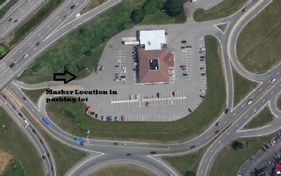
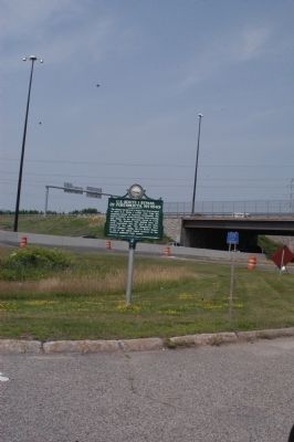
Location. 43° 4.43′ N, 70° 46.854′ W. Marker is in Portsmouth, New Hampshire, in Rockingham County. Marker is at the intersection of Woodbury Avenue (New Hampshire Route 1) and US 1 Bypass on Woodbury Avenue. Marker is in the parking lot of the NH Liquor and Wine Outlet Store #38, just off I-95, at the Rotary, on the eponymous US 1 Bypass. Touch for map. Marker is at or near this postal address: 500 Woodbury Avenue, Portsmouth NH 03801, United States of America. Touch for directions.
Other nearby markers. At least 8 other markers are within walking distance of this marker. Soldiers and Sailors Monument (approx. 0.8 miles away); Spanish American War Memorial (approx. 0.8 miles away); Portsmouth Naval Shipyard Memorial (approx. 0.8 miles away); James Baxter Sergeant (approx. 0.8 miles away); CMoMM (SS) Arthur L. Stanton Chief of the Boat (COB) (approx. 0.9 miles away); New Hampshire's Lost Boat (approx. 0.9 miles away); USS Albacore SS 218 Memorial (approx. 0.9 miles away); New Hampshire's First Black Church (approx. 0.9 miles away). Touch for a list and map of all markers in Portsmouth.
Credits. This page was last revised on December 13, 2023. It was originally submitted on July 13, 2015, by James R. Murray of Elkton, Florida. This page has been viewed 537 times since then and 37 times this year. Last updated on November 4, 2023, by Kelly Marsh of Moultonboro, New Hampshire. Photos: 1, 2, 3. submitted on July 13, 2015, by James R. Murray of Elkton, Florida. • Michael Herrick was the editor who published this page.


