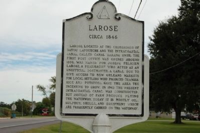
Larose in Lafourche Parish, Louisiana — The American South (West South Central)
Larose
Circa 1846
Topics. This historical marker is listed in these topic lists: Industry & Commerce • Settlements & Settlers • Waterways & Vessels. A significant historical year for this entry is 1890.
Location. 29° 33.844′ N, 90° 21.844′ W. Marker is in Larose, Louisiana, in Lafourche Parish. Marker is on West Main Street (State Highway 1) east of West 23rd Street, on the right when traveling south. Located in front of the Larose Cut-Off Middle School. Touch for map. Marker is at or near this postal address: 13356 W Main St, Larose LA 70373, United States of America. Touch for directions.
Other nearby markers. At least 8 other markers are within 13 miles of this marker, measured as the crow flies. Our Lady of the Rosary Catholic Church (approx. 1.2 miles away); Curole House (approx. 3.8 miles away); Cote Blanche (approx. 3.9 miles away); Galliano (approx. 9.8 miles away); Bouverans Plantation House (approx. 9.8 miles away); Holy Savior Cemetery (approx. 11.7 miles away); Lockport (approx. 12 miles away); Vacherie-Gheens (approx. 12.2 miles away).
Credits. This page was last revised on September 1, 2023. It was originally submitted on July 19, 2015. This page has been viewed 510 times since then and 25 times this year. Photo 1. submitted on July 19, 2015. • Bernard Fisher was the editor who published this page.
Editor’s want-list for this marker. Wide shot of marker and its surroundings. • Can you help?
