Big Piney in Sublette County, Wyoming — The American West (Mountains)
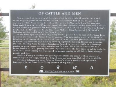
Of Cattle and Men
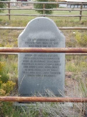
Route of the Lander Cut-off
Photographed by Barry Swackhamer, August 25, 2014
1. Of Cattle and Men Marker
In the early open range days, Big Piney ranches pastured cattle east of the Green River in winter and west of the Green River in summer. The devastating winter of 1889-1890 killed up to 90 percent of the stock, and from then on, ranchers grew hay to feed livestock in winter. Hay meadows were built by clearing sagebrush, running ditches and irrigating the land. The Big Piney Roundup Association formed in the early 1890s to self-manage grazing on the open range, and other associations followed. With the creation of the U.S. Forest Service in 1905, grazing fees were implemented
this page online
Sublette County’s ranchers and grazing associations are proud of their history of stewardship on the range, which has helped keep our area beautiful and rich in wildlife.
For more information about Subllette County’s historic ranches and agriculture industry, visit Green River Valley Museum in Big Piney.
Erected by Sublette County Museum Board.
Topics. This historical marker is listed in these topic lists: Agriculture • Industry & Commerce • Railroads & Streetcars. A significant historical year for this entry is 1858.
Location. 42° 35.106′ N, 110° 5.302′ W. Marker is in Big Piney, Wyoming, in Sublette County. It is at the intersection of U.S. 189 and Wyoming Highway 351, on the right when traveling south on U.S. 189. Touch for map. Marker is at or near this postal address: 10812 US Highway 189, Big Piney WY 83113, United States of America. Touch for directions.

Regionally, this marker is in Greater Yellowstone. It is also in the American Mountain West. Globally, it is
Photographed by Barry Swackhamer, August 25, 2014
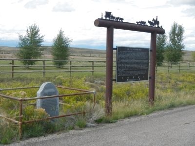
2. Of Cattle and Men Marker
Photographed by Barry Swackhamer, August 25, 2014
3. Lander Trail Marker adjacent to the Of Cattle and Men Marker
Route of the Lander Cut-off, first government financed road in Wyoming. Officially called Ft. Kearny, South Pass and Honey Lake Road. Built in 1858 from Rocky Ridge to Ft. Hall to provide shorter route for emigrants.
Erected by
Wyoming Historical Landmark Commission
1947
This marker is duplicated at the intersection of US Highway and Wyoming State Route 351.
Credits. This page was last revised on June 16, 2016. It was originally submitted on January 29, 2015, by Barry Swackhamer of Brentwood, California. This page has been viewed 563 times since then and 19 times this year. Last updated on July 20, 2015, by Barry Swackhamer of Brentwood, California. Photos: 1, 2, 3. submitted on January 29, 2015, by Barry Swackhamer of Brentwood, California. • Andrew Ruppenstein was the editor who published this page.
