Tunbridge in Orange County, Vermont — The American Northeast (New England)
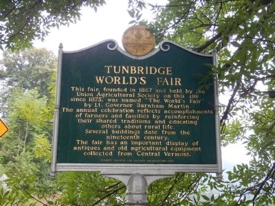
Tunbridge World's Fair
This fair, founded in 1867 and held by the Union Agricultural Society on this site since 1875, was named "The World's Fair' by Lt. Governor Burnham Martin. The annual celebration reflects accomplishments of farmers and families by reinforcing their shared traditions and educating others about rural life. Several buildings date from the nineteenth century. The fair has an important display of antiques and old agricultural equipment collected from Central Vermont.
Erected 1997 by Vermont Division for Historic Preservation.
Topics. This historical marker is listed in this topic list: Agriculture. A significant historical year for this entry is 1867.
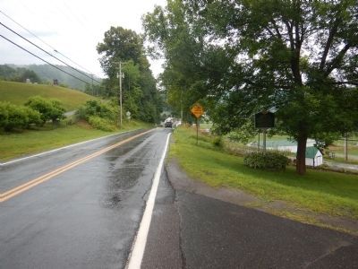
Location. 43° 53.246′ N, 72° 29.651′ W. Marker is in Tunbridge, Vermont, in Orange County. Marker is at the intersection of Vermont Route 110 and Potash Hill Road, on the right when traveling south on State Route 110. Marker is located adjacent the Town Clerk's Office. Touch for map. Marker is in this post office area: Tunbridge VT 05077, United States of America. Touch for directions.
Other nearby markers. At least 8 other markers are within 6 miles of this marker, measured as the crow flies. Tunbridge Civil War Memorial (a few steps from this marker); Site of 1780 Raid (approx. 2˝ miles away); Wagon Wheels Farm (approx. 3.7 miles away); Jessie LaFountain Bigwood (approx. 4.7 miles away); Joseph Smith Monument (approx. 5.2 miles away); The Royalton Raid (approx. 5.6 miles away); Burning of Royalton (approx. 5.6 miles away); Stone Turnpike Marker (approx. 5.6 miles away). Touch for a list and map of all markers in Tunbridge.
Credits. This page was last revised on June 16, 2016. It was originally submitted on July 23, 2015, by Kevin Craft of Bedford, Quebec. This page has been viewed 490 times since then and 22 times this year. Photos: 1, 2. submitted on July 23, 2015, by Kevin Craft of Bedford, Quebec. • Bill Pfingsten was the editor who published this page.

