
Crow Agency in Big Horn County, Montana — The American West (Mountains)
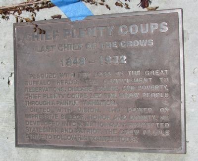
Chief Plenty Coups
Last Chief of the Crows
| — | 1848 - 1932 | — |
Photographed by Bill Coughlin, July 23, 2015
1. Chief Plenty Coups Marker
Plagued with the loss of the great buffalo herds, the confinement to reservations, disease, famine, and poverty, Chief Plenty Coups led the Crow people through a painful transition.
Gifted with vision, the power of impressive speech, honor and dignity, he developed into a nationally respected statesman and patriot. The Crow people strive to follow his example today.
Topics. This historical marker is listed in these topic lists: Government & Politics • Indigenous Peoples and Communities.
Location. 45° 34.729′ N, 107° 26.86′ W. Marker is in Crow Agency, Montana, in Big Horn County. It is at the intersection of U.S. 212 and Frontage Road, on the right when traveling west on U.S. 212. Touch for map. Marker is in this post office area: Crow Agency MT 59022, United States of America. Touch for directions.

Regionally, this marker is in Montana’s and he Crow Nation, in Southeast Montana, in Custer Country. It is also in the American Mountain West, in the Lewis & Clark Corridor, on the prairies, on the Great Plains, and specifically on the Northern Plains.
this page online
Other nearby markers. At least 8 other markers are within one mile of this marker, measured as the crow flies: National Cemetery (approx. one mile away); Here We Remember the Fallen (approx. one mile away); Bear Paw Monument (approx. one mile away); Bear Paw Memorial (approx. one mile away); Wooden Leg Hill (approx. 1.1 miles away); Seventh Cavalry Horse Cemetery (approx. 1.1 miles away); Peace Through Unity (approx. 1.1 miles away); 1984 Archeological Survey (approx. 1.1 miles away). Touch for a list and map of all markers in Crow Agency.
Photographed by Bill Coughlin, July 23, 2015
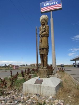
2. Chief Plenty Coups Marker
Photographed by Bill Coughlin, July 23, 2015
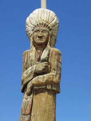
3. Closeup of Chief Plenty Coups
Credits. This page was last revised on March 5, 2026. It was originally submitted on July 23, 2015, by Bill Coughlin of Woodland Park, New Jersey. This page has been viewed 797 times since then and 28 times this year. Photos: 1, 2, 3. submitted on July 23, 2015, by Bill Coughlin of Woodland Park, New Jersey.
