Near Jetersville in Amelia County, Virginia — The American South (Mid-Atlantic)
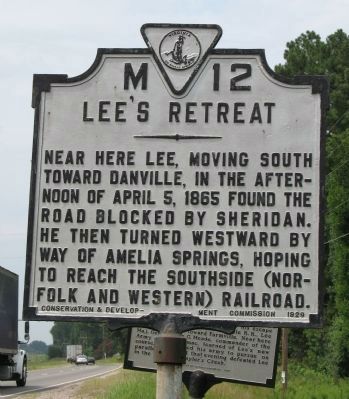
Lee's Retreat
Erected 1929 by Conservation and Development Commission. (Marker Number M-12.)
Topics and series. This historical marker is listed in this topic list: War, US Civil. In addition, it is included in the Virginia Department of Historic Resources (DHR) series list. A significant historical date for this entry is April 5, 2001.
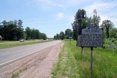
Location. 37° 18.674′ N, 78° 4.155′ W. Marker is near Jetersville, Virginia, in Amelia County. Marker is on Patrick Henry Highway (U.S. 360) west of Mt. Zion Road (County Route 639), on the right when traveling west. Touch for map. Marker is in this post office area: Jetersville VA 23083, United States of America. Touch for directions.
Other nearby markers. At least 8 other markers are within 4 miles of this marker, measured as the crow flies. A different marker also named Lee's Retreat (here, next to this marker); Jetersville (approx. 1.9 miles away); a different marker also named Lee's Retreat (approx. 2 miles away); a different marker also named Lee's Retreat (approx. 2 miles away); a different marker also named Lee's Retreat (approx. 2 miles away); Amelia Springs (approx. 2.7 miles away); a different marker also named Amelia Springs (approx. 2.7 miles away); Nottoway County / Amelia County (approx. 4.1 miles away). Touch for a list and map of all markers in Jetersville.
Also see . . . Lee's Retreat. Map and tour guide to key locations along the retreat route. (Submitted on August 14, 2008, by Craig Swain of Leesburg, Virginia.)
Credits. This page was last revised on June 16, 2016. It was originally submitted on August 14, 2008, by Laura Troy of Burke, Virginia. This page has been viewed 1,398 times since then and 23 times this year. Last updated on July 25, 2015, by J. Makali Bruton of Accra, Ghana. Photos: 1. submitted on August 14, 2008, by Laura Troy of Burke, Virginia. 2. submitted on May 16, 2009, by Bernard Fisher of Richmond, Virginia. • Bill Pfingsten was the editor who published this page.

