Nancy in Pulaski County, Kentucky — The American South (East South Central)
"Poor Charlie"
Photographed by Brandon Fletcher, April 1, 2012
1. "Poor Charlie" Marker
The Battle - Confederate Retreat
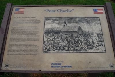
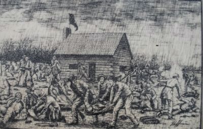
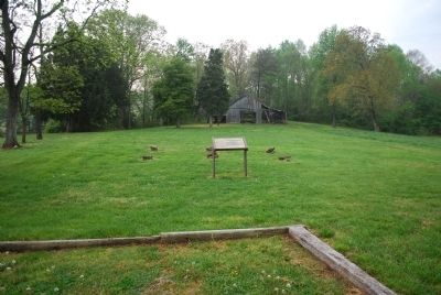
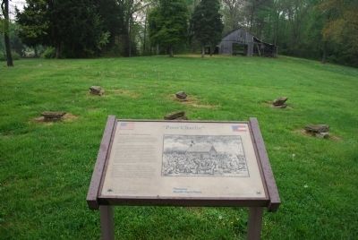
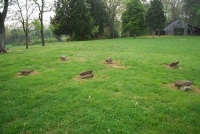
During the battle a small one room log cabin stood here (the foundation stones are still visible). Retreating Federal pickets made a brief but desperate stand in and around this cabin at the beginning of the battle. This action slowed the Confederate advance giving the Federal army time to rush troops forward to meet the advancing Confederates.
As soon as the Federal pickets were pushed back Confederate surgeons occupied the cabin and set up a field hospital. This hospital operated throughout the battle treating wounded soldiers. some came here on their own and others were carried here by friends. One of the last to be brought here was Charlie Clemenson of the 19th Tennessee. He was left at the hospital by his friends as the defeated Confederate army was retreating past this site. W.J. Worsham was one of the men who brought Charlie here and describes the scene. "Pink Henderson, Clabe Perry and the writer carried Charlie from the field in a blanket....Poor Charlie was dying as when we laid him down. We can never forget the sad anxious expression of his face as we left him in his last sad trail of life, dying alone deserted by all, who he thought were friends, left on the cold ground with naught but the cold rain to wash the sweat of death for his brow."
The
this page online
Erected 1997 by Human Health Care Plans.
Topics. This historical marker is listed in this topic list: War, US Civil.
Location. This marker has been replaced by another marker nearby. It was located near 37° 2.772′ N, 84° 44.11′ W. Marker was in Nancy, Kentucky, in Pulaski County. It could be reached from Kentucky Route 235 south of McGlothin Road, on the right when traveling south. Touch for map. Marker was in this post office area: Nancy KY 42544, United States of America. Touch for directions.

Regionally,
Photographed by Brandon Fletcher, April 1, 2012
2. "Poor Charlie" Marker
Other nearby markers. At least 8 other markers are within walking distance of this location: A different marker also named "Poor Charlie" (a few steps from this marker); Confederate Field Hospital (within shouting distance of this marker); Turpin/Simpson Properties (approx. 0.4 miles away); Rutledge's Battery (approx. half a mile away); The Last Stand (approx. half a mile away); Confederate Retreat (approx. 0.6 miles away); The Union Advance (approx. 0.6 miles away); Victory! (approx. 0.6 miles away). Touch for a list and map of all markers in Nancy.
Another marker is no longer nearby. Confederate Artillery (was approx. 0.6 miles away but has been reported to have been replaced with another marker now near it).
More about this marker.
Photographed by Brandon Fletcher, April 1, 2012
3. "Poor Charlie" Marker
Photographed by Brandon Fletcher, April 1, 2012
4. "Poor Charlie" Marker
Photographed by Brandon Fletcher, April 1, 2012
5. Log Cabin Foundation Stones
Photographed by Brandon Fletcher, April 1, 2012
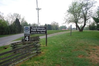
6. "Poor Charlie" Marker
Credits. This page was last revised on August 2, 2019. It was originally submitted on July 25, 2015, by Brandon Fletcher of Chattanooga, Tennessee. This page has been viewed 475 times since then and 25 times this year. Photos: 1, 2, 3, 4, 5, 6. submitted on July 25, 2015, by Brandon Fletcher of Chattanooga, Tennessee. • Bernard Fisher was the editor who published this page.
