Richmond in Madison County, Kentucky — The American South (East South Central)
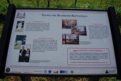
Saving the Richmond Battlefield
I. Commemoration
The Battle of Richmond ended on August 30, 1862. Over the years, monuments and historic markers were erected to commemorate the battle and the battlefield was listed in the National Register of Historic Places. In 1993, the Battle of Richmond was recognized as one of the nation's most significant and endangered battlefields by the United States Congress.
II. Battlefield in Crisis
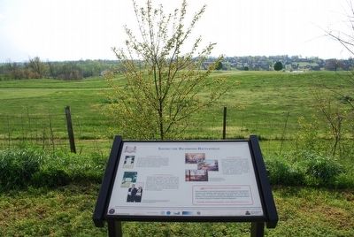
Although the significance of the battlefield was recognized, little had been done to protect the land. Although Madison County was growing rapidly, much of the battlefield outside of the City of Richmond was still open land, as it had been in 1862. That changed in 1999 when the property known as "Battlefield Farm" was sold and developed. The residences and golf course in front of you are the result of that development.
III. Preservation
Losing that important part of the battlefield to development spurred the creation of the Battle of Richmond Association. That development led to Charles Hay and Bob Moody purchasing for the Madison County Historical Society 62 acres of core battlefield in 2001, including this area and Pleasant View, the brick house to your left. In 2002 the Battle of Richmond Association, a non-profit organization, was created to assume the preservation effort.
(sidebar)
You Can Help Preserve the Richmond Battlefield!
Without the efforts of local and state government, local leaders and many dedicated volunteers, this battlefield might have been lost to development. Preserving our nation's history is everyone's responsibility. Individuals can and do make a difference. You can help preserve the Richmond Battlefield by becoming a volunteer or by making a donation to the Battle of Richmond Association.
The Battle of Richmond Association: www.battleofrichmond.org
Topics. This historical marker is listed in this topic list: War, US Civil. A significant historical year for this entry is 1862.
Location. 37° 39.924′ N, 84° 15.146′ W. Marker is in Richmond, Kentucky, in Madison County. Marker can be reached from Battlefield Memorial Highway (U.S. 421) near Hays Fork Lane, on the right when traveling south. Touch for map. Marker is at or near this postal address: 101 Battlefield Memorial Hwy, Richmond KY 40475, United States of America. Touch for directions.
Other nearby markers. At least 8 other markers are within walking distance of this marker. "Good, Common-Sense Soldiering" (about 300 feet away, measured in a direct line); Barnett Burial Ground (about 300 feet away); The Union Trail (about 400 feet away); A Reckless And Useless Charge (about 400 feet away); Sharpshooters Check The Union Right (about 500 feet away); "The Loud Mouthed Dogs of War Were Unleashed" (about 600 feet away); A Near Fatal Mistake (about 600 feet away); Battle of Richmond (about 600 feet away). Touch for a list and map of all markers in Richmond.
Credits. This page was last revised on February 21, 2021. It was originally submitted on July 27, 2015, by Brandon Fletcher of Chattanooga, Tennessee. This page has been viewed 412 times since then and 23 times this year. Photos: 1, 2, 3. submitted on July 27, 2015, by Brandon Fletcher of Chattanooga, Tennessee. 4. submitted on February 21, 2021, by Bradley Owen of Morgantown, West Virginia. • Bernard Fisher was the editor who published this page.


