
Decatur in Morgan County, Alabama — The American South (East South Central)
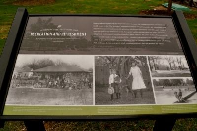
Recreation and Refreshment
Restoring the Vision ... Preserving the Legacy
Photographed by Sandra Hughes, June 12, 2010
1. Recreation and Refreshment Marker
Franklin Delano Roosevelt
Delano park was created with the democratic vision of a space that provides recreation and refreshment for all. As part of the "City Beautiful" movement of the late 19th century, parks and greenspaces were important components of sound civic planning. Early known recreational uses of the park included a nine hole golf course and tennis courts. New public facilities added during the 1930's included a playground, wading pool, bandstand (gazebo), dance pavilion, and picnic shelters. The recreational improvements made in the park in the 1930's "revealed that economic and social hard times did not cause an abandonment of imagination, humor, or fun." As Decatur's oldest planned public park, Delano park continues its role as a space for all people to reconnect with one another and nature.
Captions:
The improvements made at Delano Park in the 1930’s brought new recreational opportunities for area residents.
this page online
Lawson Davidson, pictured above with his sister Christine, was born across Gordon Drive from the park in 1906. He recalled a time when his cow grazed in the park and children built underground forts. In the 1920’s, he was paid 25 cents to caddy on the nine hole golf course. The park also served as an outdoor theatre for children, and during the summer, a Chautauqua provided formal entertainment for adults.
(top) The Civil Works Administration (CWA) bathhouse and wading pool, shown under construction in 1933, offered refreshment for Decatur children. (bottom) Claudia Wright and Shirley Blankenship enjoy the wading pool in the park in 1956.
Topics. This historical marker is listed in these topic lists: Entertainment • Environment. A significant historical year for this entry is 1941.
Location. 34° 35.832′ N, 86° 58.65′ W. Marker is in Decatur, Alabama, in Morgan County. It is at the intersection of 8th Street
Photographed by Sandra Hughes, October 13, 2009
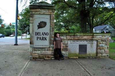
2. Delano Park "The Chicago of the South"
Under the direction of Capt. Barrett, the well-known landscape engineer, the residence portion of the city has been laid out with a view to beauty, comfort and recreation.
The streets, avenues, and drives are broad and are dotted at intervals with beautiful parks.
in 1886 a group of visionary men quietly set out to bring about the rebirth of the little village of Decatur. The Civil war devastated the lawn leaving only four structures standing in 1865.
The financial panic that followed the war and the yellow fever epidemic of 1878 reduced the population to 400 in 1880. Nevertheless, Decatur's favorable location in the Tennessee Valley attracted the attention of Major EC Gardon, CC Harris, and WW Littlejohn. They envisioned New Decatur as "The Chicago of the South", because of its superior location on the river and the crossing of two great railroads. The Decatur land improvement and Furnace Company was formed on Jan 11, 1887. The land company chose Landscape Architect Nathan Franklin Barrett (1845-1918) renowned for his landscapes design of Pullman, Illinois, is lay out the Chicago of the south with broad boulevards, and a large organically shaped park as the focal point of the development Nationally acclaimed sanitary engineer, George Edwin Waring Jr. 1833-1888 designed the drainage and sanitary systems for the "Gateway city". This group of gifted men envisioned new Decatur as both industrial and transportation center and healthful and beautiful place in which to live.
Stone structure made possible in part by generous gifts fro the State of Alabama Bureau of Tourism and Travel and Decatur Daily

Regionally, this marker is in North Alabama. It is also in the American South, specifically in the Deep South, in Appalachia, and specifically in Southern Appalachia. Globally, it is in North America, a Gulf of Mexico state, the Western Hemisphere, the Western World, and the Anglosphere. Historically, it finds itself in what was once the original Cherokee Nation, the territory of the Mississippian Culture, one of the Confederate States of America, and the Antebellum South.
Other nearby markers. At least 8 other markers are within walking distance of this marker: Health and Civic Welfare (within shouting distance of this marker); The Land of the Indians (within shouting distance of this marker); Carolyn Cortner Smith (about 400 feet away, measured in a direct line); Beauty and Hope (about 500 feet away); Social and Cultural Opportunities (about 700 feet away); Albany (approx. 0.2 miles away); a different
Photographed by Sandra Hughes, October 13, 2009
3. Delano Park
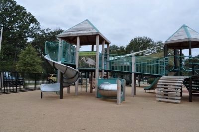
New Play Ground for Children to enjoy.
Photographed by Sandra Hughes, October 13, 2009
4. Delano Park
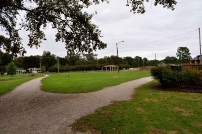
Walking trail, picnic shelters, public facilities.
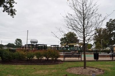
Photographed by Sandra Hughes, October 13, 2009
5. Delano Park
No longer a wading pool but now a splash pad for children to enjoy.
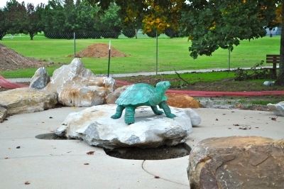
Photographed by Sandra Hughes, October 13, 2009
6. Delano Park
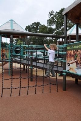
Photographed by Sandra Hughes, October 13, 2009
7. Delano Park
Credits. This page was last revised on June 16, 2016. It was originally submitted on March 19, 2012, by Sandra Hughes Tidwell of Killen, Alabama, USA. This page has been viewed 987 times since then and 25 times this year. Last updated on July 30, 2015, by J. Makali Bruton of Washington, District of Columbia. Photos: 1, 2, 3, 4, 5, 6, 7. submitted on March 19, 2012, by Sandra Hughes Tidwell of Killen, Alabama, USA. • Bill Pfingsten was the editor who published this page.
