Rocky Face in Whitfield County, Georgia — The American South (South Atlantic)
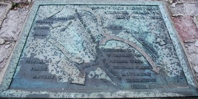
Rocky Face Ridge Phase
Atlanta Campaign
| — | May 7-12, 1864 | — |
Photographed by Brandon Fletcher, February 21, 2012
1. Rocky Face Ridge Phase Marker
(labels)
Confederate position Rocky Face Ridge
Federal attack fails / Mill Creek Gap
Federal flank movement / Dug Gap
Topics. This historical marker is listed in this topic list: War, US Civil.
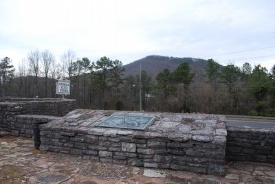
Location. 34° 48.071′ N, 85° 0.701′ W. Marker is in Rocky Face, Georgia, in Whitfield County. It is on Chattanooga Road (U.S. 41/76) 0.4 miles west of Willowdale Road NW, on the left when traveling west. Located in front of Georgia State Patrol headquarters. Touch for map. Marker is at or near this postal address: 2401 Chattanooga Rd, Rocky Face GA 30740, United States of America. Touch for directions.

Regionally, this marker is in Georgia’s Mountains. It is also in the American South, specifically in the Deep South, in Appalachia, and specifically in Southern Appalachia. Globally, it is in North America, the Western Hemisphere, the Western World, and the Anglosphere. Historically, it finds itself in what was once the original Cherokee Nation, the territory of the Mississippian
this page online
Other nearby markers. At least 8 other markers are within walking distance of this marker: George Disney's Grave (a few steps from this marker); Confederate Defense of Mill Creek Gap (a few steps from this marker); The Flooded Gap (a few steps from this marker); Mill Creek Gap (a few steps from this marker); Atlanta Campaign (within shouting distance of this marker); Battle of Mill Creek Gap (within shouting distance of this marker); a different marker also named The Battle of Mill Creek Gap (approx. 0.3 miles away); a different marker also named Mill Creek Gap (approx. 0.7 miles away). Touch for a list and map of all markers in Rocky Face.
More about this marker. Developed by the WPA, this Atlanta Campaign pocket parks is one of five leading to Atlanta. 1) Ringgold, 2)Rocky Face Ridge, 3)Resaca, 4)Cassville, 5)New Hope Church.
(See the link attached to this page)
Also see . . . Pruning the Parks: Atlanta Campaign National Historic Site (1944-1950) was Developed as a Dixie High. (Submitted on July 31, 2015, by Brandon Fletcher of Chattanooga, Tennessee.)
Additional keywords. Atlanta
Photographed by Brandon Fletcher, February 21, 2012
2. Rocky Face Ridge Phase Marker
Photographed by Brandon Fletcher, February 21, 2012
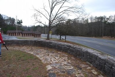
3. Rocky Face Ridge Phase Marker
Looking left from the marker
Photographed by Brandon Fletcher, February 21, 2012
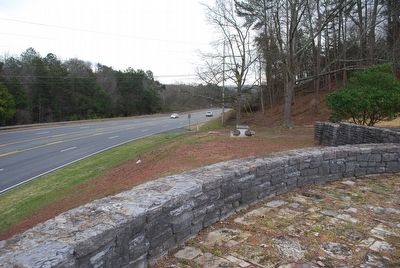
4. Rocky Face Ridge Phase Marker
Looking right from the marker
Photographed by Brandon Fletcher, February 21, 2012
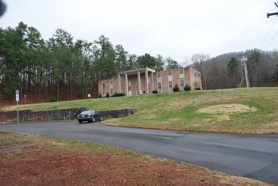
5. Rocky Face Ridge Phase Marker
Georgia State Patrol Headquarters, behind the marker
Photographed by Brandon Fletcher, April 16, 2014
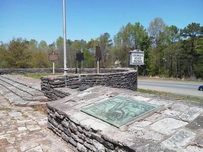
6. Rocky Face Ridge Phase Marker
In 2014, This group of local markers were moved to this location in relation to the Rocky Face Ridge Phase Atlanta Campaign Roadside Park Marker. It is assumed for the reason of the 150th anniversary- making it easier for folks to see all the markers at one location.
Credits. This page was last revised on November 24, 2019. It was originally submitted on July 31, 2015, by Brandon Fletcher of Chattanooga, Tennessee. This page has been viewed 1,638 times since then and 78 times this year. Photos: 1, 2, 3, 4, 5. submitted on July 31, 2015, by Brandon Fletcher of Chattanooga, Tennessee. 6. submitted on August 17, 2015, by Brandon Fletcher of Chattanooga, Tennessee. • Bernard Fisher was the editor who published this page.
